
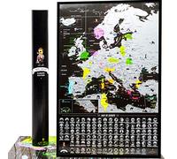
£10.02
amazon.co.uk
Free Delivery
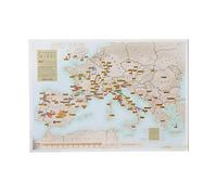
£34.95
amazon.co.uk
Free Delivery

Football Ground Map European Football Stadium A1 Wall Poster (folded to A4) - includes every major stadium with a capacity 40,000+, Multicolor
£9.99
Amazon-marketplace.co.uk
Delivery from £4.49
HUGE LAMINATED/ENCAPSULATED Map Of Europe English European Road Map - POSTER
£9.99
Amazon-marketplace.co.uk
Delivery from £6.00
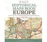
The Family Tree Historical Maps Book - Europe: A Country-by-Country Atlas of European History, 1700s-1900s
£58.50
Amazon-marketplace.co.uk
Free Delivery

From Cassackia to Kazakhstan: Localization of Kazakhstan on European, Russian and Asian Maps from the 16th to the first half of the 20th centuries
£25.00
amazon.co.uk
Free Delivery

Soviet Ghosts, European Dreams and a Bag of Onions: Moldova
£15.78
amazon.co.uk
Free Delivery
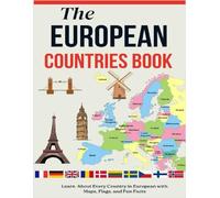
The European Countries Book: Learn About Every Country in Europe with Maps, Flags, and Fun Facts
£5.92
amazon.co.uk
Delivery from £2.99

European Railway Atlas - Designed for Interrail / Eurail Rail Pass: Includes detailed Atlas for Switzerland, Austria and Alpine border routes
£18.00
amazon.co.uk
Free Delivery

European Railway Atlas 2023: Designed for Interrail/Eurail Global Rail Pass - Includes detailed InfoRailMap for Austria, French Alps, Northern Italy and Switzerland
£20.00
amazon.co.uk
Free Delivery

European Railway Atlas - Designed for Interrail/Eurail Rail Pass: Includes Detailed Atlas for Switzerland, Austria and Alpine border routes (Discover ... Designed for Interrail and Eurail Rail Pass)
£16.00
amazon.co.uk
Free Delivery

£6.37
Amazon-marketplace.co.uk
Delivery from £4.99

£25.36
Amazon-marketplace.co.uk
Free Delivery
£5.68
Amazon-marketplace.co.uk
Delivery from £4.99

£13.75
amazon.co.uk
Free Delivery

£13.38
amazon.co.uk
Free Delivery

£6.99
amazon.co.uk
Delivery from £2.99

KENYA TANZANIA UGANDA RWANDA ROAD MAP (Paperback) (9783707913880)
£18.39
ebay.co.uk
Free Delivery
EUROPE TOURIST/MOTORING ATLAS A4 SPIRAL (Spiral) (9782067173682)
£19.56
ebay.co.uk
Free Delivery
Color By Number: European Flags For Kids (Ages 5-15): Learn the Flags, Capitals, Maps, Country Names, and Populations of 50 European Countries - Fun and Educational Geography Activity Book
£9.99
amazon.co.uk
Delivery from £2.99

£4.08
Amazon-marketplace.co.uk
Delivery from £2.80

£4.99
amazon.co.uk
Delivery from £2.99

£44.01
Amazon-marketplace.co.uk
Free Delivery
£5.90
Amazon-marketplace.co.uk
Delivery from £4.99

£15.83
Amazon-marketplace.co.uk
Delivery from £7.74

Wine Map of Austria & Hungary Bookshelf Edition
£15.46
Amazon-marketplace.co.uk
Delivery from £7.74
£42.97
Amazon-marketplace.co.uk
Free Delivery

£28.75
Amazon-marketplace.co.uk
Delivery from £2.80

£12.99
Amazon-marketplace.co.uk
Delivery from £21.75

£11.91
amazon.co.uk
Free Delivery

£19.94
Amazon-marketplace.co.uk
Delivery from £4.61

£9.95
amazon.co.uk
Delivery from £2.99

Physical Map of Germany - Size A0-84.1 x 118.9cm - Paper Laminated
£18.99
Amazon-marketplace.co.uk
Delivery from £4.00

Physical Map of France - Size A0-84.1 x 118.9cm - Paper Laminated
£18.99
Amazon-marketplace.co.uk
Delivery from £4.00
Scratch Off European Wine Print - Maps International - poster gift for wine lovers enthusiasts - regions + sub-regions - 42 (h) x 29.7 (w) cm
£10.99
Amazon-marketplace.co.uk
Free Delivery

Tiger Moon Political Map of France - A2 Size, Glossy Paper, Laminated
£12.99
Amazon-marketplace.co.uk
Delivery from £4.00

Physical Map of Germany - Size A0-84.1 x 118.9 cm - Vinyl
£22.99
Amazon-marketplace.co.uk
Delivery from £4.00
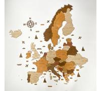
3D Wooden map of Europe - Wall Decor - Map Size (M, L, XL) - Wall Art For Home, Kitchen or Office (75 x 75 cm)
£79.00
Amazon-marketplace.co.uk
Free Delivery

Physical Map of Poland - Size A0-84.1 x 118.9cm - Paper Laminated
£18.99
Amazon-marketplace.co.uk
Delivery from £4.00

Physical Map of Cyprus - Size A1-59.4 x 84.1 cm - Paper Laminated
£15.99
Amazon-marketplace.co.uk
Delivery from £4.00
- 1
- 2
- 3
- 4
- next page
Informations about "european country maps"
With Pricehunter, you can compare offers online in order to find the bid that most fulfills your requirements "european country maps".
Based on your search criteria "european country maps", our price search engine found the lowest prices in 31 categories.
About "european country maps"
- Lowest prices found in 6 different online stores, including Amazon-marketplace.co.uk, Millets.co.uk, Blacks.co.uk and amazon.co.uk.
- After having chosen your companies you may also choose the delivery company. 6 delivery producers are available The AA, Insight Guides, Forgotten Books and Michelin being the most popular.
- 6 different producers offer the product - The AA, Insight Guides, Forgotten Books and Michelin, that you were looking for.
- Furthermore, other clients researched for the following product .
- With Pricehunter you are also spoilt for choice for colours. You can select your favourite from 0 shades. The article is most commonly ordered in the colour .
Don't forget your voucher code:
Report Illegal Concerns
You are about to report a violation based on the EU Digital Services Act (DSA).