£6.43
amazon.co.uk
Delivery from £2.99

£5.03
Amazon-marketplace.co.uk
Delivery from £2.80

£3.50
amazon.co.uk
Delivery from £2.99

£6.84
Amazon-marketplace.co.uk
Delivery from £6.99

£4.99
Amazon-marketplace.co.uk
Free Delivery

£8.33
Amazon-marketplace.co.uk
Delivery from £2.80

£30.08
Amazon-marketplace.co.uk
Delivery from £2.80

£8.33
Amazon-marketplace.co.uk
Delivery from £2.80

£7.80
Millets.co.uk
Delivery from £3.95

£10.39
Amazon-marketplace.co.uk
Free Delivery

£3.81
Amazon-marketplace.co.uk
Delivery from £2.80

£8.33
Amazon-marketplace.co.uk
Delivery from £2.80

£4.99
waterstones.com
Delivery from £2.99

£14.36
Amazon-marketplace.co.uk
Delivery from £2.80

£6.73
Amazon-marketplace.co.uk
Delivery from £2.80

£8.50
waterstones.com
Delivery from £2.99

£9.03
Amazon-marketplace.co.uk
Delivery from £2.80

£4.29
Amazon-marketplace.co.uk
Delivery from £2.80

£13.02
Amazon-marketplace.co.uk
Delivery from £7.74

London North: The City, West End, Enfield and Ealing: Sheet 173 (OS Explorer Map)
£12.99
Amazon-marketplace.co.uk
Delivery from £2.80

£3.50
Amazon-marketplace.co.uk
Delivery from £2.80

£8.11
Amazon-marketplace.co.uk
Delivery from £2.80

£13.99
waterstones.com
Delivery from £2.99

£12.84
amazon.co.uk
Free Delivery

Bank and the City 1873: London Large Scale Sheet 07.66 (Old Ordnance Survey Maps of London - Yard to the Mile)
£3.50
Amazon-marketplace.co.uk
Delivery from £2.80

Greater London - Postcode Sector Map 8 - Wall Map With Motorway, A' Roads, B' Roads, City Plans, Area, District, Sectors Size: 73 x 107 cm (29 x 42 inches) Scale: 1:60 000- Laminated Wall Map
£29.99
Amazon-marketplace.co.uk
Free Delivery

Greater London Sector 8 Wall Map By Postcode With M25 Motorway A' Roads, B' Roads, City Plans, Area, District, Size: 73 x 107 cm (Paper)
£24.95
Amazon-marketplace.co.uk
Free Delivery

Central London - Postcode Sector Map 37 - Wall Map With Motorway, A' Roads, B' Roads, City Plans, Area, District, SectorsSize: 73 x 107 cm (29 x 42 inches) Scale: 1:150 000 (Paper)
£24.95
Amazon-marketplace.co.uk
Free Delivery

Spiffing Prints London City Map Beacon Travelers Pocket Map 1890 - Small - Semi Gloss - Unframed Art Print Poster
£4.99
Amazon-marketplace.co.uk
Free Delivery

Reproduction Antique Map of City of London 1720s, 18th Century, by Guillaume Danet (45 x 33 cms)
£5.99
Amazon-marketplace.co.uk
Delivery from £2.80

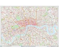
London City Centre Postcode Sectors Wall Map (C1) - Paper
£29.99
Amazon-marketplace.co.uk
Free Delivery

Holborn, Strand and City 1914: London Sheet 062.3 (Old Ordnance Survey Maps of London)
£3.50
Amazon-marketplace.co.uk
Delivery from £2.80

City Scratch-Off Map: London: A Sightseeing Scavenger Hunt (City Scratch-Off Maps) by Christina Henry de Tessan (2015-09-15)
£3.50
Amazon-marketplace.co.uk
Delivery from £3.20

Large Southeast England & Midlands Postcode Wall Map - Covering Birmingham, Bristol And London - City Plan Inlays, County Boundaries, Motorways, Primary 'A'+'B' Roads, Towns, Cities
£34.95
Amazon-marketplace.co.uk
Free Delivery

Holborn, the City and the Strand 1873: London Sheet 062.1 (Old Ordnance Survey Maps of London)
£3.50
Amazon-marketplace.co.uk
Delivery from £2.80

London's Railways Map 1897: A Coloured Map of the Railway Network That Helped to Make London the Greatest City in the World
£17.20
Amazon-marketplace.co.uk
Delivery from £7.74

Large Southeast England & Midlands Postcode Wall Map - Covering Birmingham, Bristol And London - City Plan Inlays, County Boundaries, Motorways, Primary 'A'+'B' Roads, Towns, Cities
£89.99
Amazon-marketplace.co.uk
Free Delivery

City centre London Colouring Map: A Colouring Book for Geography and Map Lovers
£13.19
amazon.co.uk
Free Delivery

LONDON ROAD MAP ATLAS 2025/2026: Explore The City With Precision & Ease
£14.70
amazon.co.uk
Free Delivery

LONDON ROAD MAP ATLAS 2025/2026: Explore The City With Precision & Ease
£22.44
amazon.co.uk
Free Delivery
- 1
- 2
- 3
- 4
- 5
- next page
Informations about "london city map"
With Pricehunter, you can compare buy prices online in order to find the offer that most fulfills your requirements "london city map".
Based on your search criteria "london city map", our price search engine found the lowest prices in 42 categories.
About "london city map"
- Lowest prices found in 15 different mail order companies, including Amazon-marketplace.co.uk, amazon.co.uk, waterstones.com and dunelm.com.
- If you would prefer an item from a particular manufacturers, you can find 14 shops for this product. If you have not yet made a decision, you can also filter your favourite producers and choose between 14 manufacturers.
- 14 different manufacturers offer the product - Artery8, Collins, Penguin Books and Michelin, that you were looking for.
- Furthermore, other costumers also looked for the following product .
- With Pricehunter you are also spoilt for choice for colours. You can select your favourite from 29 colours. The article is most commonly ordered in the colour Black.
Don't forget your voucher code:
Report Illegal Concerns
You are about to report a violation based on the EU Digital Services Act (DSA).