
Cinque Terre High Path: 1:25000: 4006 (National Geographic Trails Illustrated Map)
Cinque Terre High Path Hiking Map - 1:25,000 Scale | National Geographic Trails Illustrated 4006 | Waterproof Trail Map of Italy’s Ligurian Coast

Overall Rating: 4.8 / 5 (average from multiple review sources, as of 12 Jul 2026)
Based on a total of 80,610 customer reviews from independent review platforms.
Sources & Transparency:
The values are derived from publicly available retailer ratings from platforms such as Feefo, http://Reviews.io , Trustpilot, and others, and are aggregated monthly.
All brand names and logos are the property of their respective owners.
Notice:
pricehunter.co.uk cannot guarantee that published shop ratings originate from consumers who have actually made a purchase from the reviewed retailer.
Cheapest Price
In stock
Direct debit
Direct debit
Visa
Visa
Mastercard
Mastercard
£12.12
Delivery from £2.80
Cinque Terre High Path Hiking Map - 1:25,000 Scale | National Geographic Trails Illustrated 4006 | Waterproof Trail Map of Italy’s Ligurian Coast

Overall Rating: 2.3 / 5 (average from multiple review sources, as of 23 Jul 2026)
Based on a total of 47,137 customer reviews from independent review platforms.
Sources & Transparency:
The values are derived from publicly available retailer ratings from platforms such as Feefo, http://Reviews.io , Trustpilot, and others, and are aggregated monthly.
All brand names and logos are the property of their respective owners.
Notice:
pricehunter.co.uk cannot guarantee that published shop ratings originate from consumers who have actually made a purchase from the reviewed retailer.
Cheapest Total Price
In stock. Express Delivery available with Amazon Prime.
Direct debit
Direct debit
Visa
Visa
Mastercard
Mastercard
£14.93
Free Delivery
Cinque Terre High Path Hiking Map - 1:25,000 Scale | National Geographic Trails Illustrated 4006 | Waterproof Trail Map of Italy’s Ligurian Coast
Overall Rating: 4.8 / 5 (average from multiple review sources, as of 12 Jul 2026)
Based on a total of 80,610 customer reviews from independent review platforms.
Sources & Transparency:
The values are derived from publicly available retailer ratings from platforms such as Feefo, http://Reviews.io , Trustpilot, and others, and are aggregated monthly.
All brand names and logos are the property of their respective owners.
Notice:
pricehunter.co.uk cannot guarantee that published shop ratings originate from consumers who have actually made a purchase from the reviewed retailer.
Based on a total of 80,610 customer reviews from independent review platforms.
Sources & Transparency:
The values are derived from publicly available retailer ratings from platforms such as Feefo, http://Reviews.io , Trustpilot, and others, and are aggregated monthly.
All brand names and logos are the property of their respective owners.
Notice:
pricehunter.co.uk cannot guarantee that published shop ratings originate from consumers who have actually made a purchase from the reviewed retailer.
Usually dispatched within 2 to 3 days
Direct debit
Direct debit
Visa
Visa
Mastercard
Mastercard
£16.98
Free Delivery
Cinque Terre High Path Hiking Map - 1:25,000 Scale | National Geographic Trails Illustrated 4006 | Waterproof Trail Map of Italy’s Ligurian Coast
Overall Rating: 4.8 / 5 (average from multiple review sources, as of 12 Jul 2026)
Based on a total of 80,610 customer reviews from independent review platforms.
Sources & Transparency:
The values are derived from publicly available retailer ratings from platforms such as Feefo, http://Reviews.io , Trustpilot, and others, and are aggregated monthly.
All brand names and logos are the property of their respective owners.
Notice:
pricehunter.co.uk cannot guarantee that published shop ratings originate from consumers who have actually made a purchase from the reviewed retailer.
Based on a total of 80,610 customer reviews from independent review platforms.
Sources & Transparency:
The values are derived from publicly available retailer ratings from platforms such as Feefo, http://Reviews.io , Trustpilot, and others, and are aggregated monthly.
All brand names and logos are the property of their respective owners.
Notice:
pricehunter.co.uk cannot guarantee that published shop ratings originate from consumers who have actually made a purchase from the reviewed retailer.
In stock
Direct debit
Direct debit
Visa
Visa
Mastercard
Mastercard
£22.56
Free Delivery
Cheapest offer
Pages: 46, Edition: 2024th ed., Map, National Geografisch Inst
£12.12
In stock
Amazon-marketplace.co.uk
How well did the information meet your expectations and assist you further?
Your responses remain anonymous and are used solely to improve our website. No personal data will be stored or shared with third parties.
🤖 Ask ChatGPT
💡 Is it worth the price?
🔁 Better alternatives?
⭐ What do users say?
Cinque Terre High Path Hiking Map - 1:25,000 Scale | National Geographic Trails Illustrated 4006 | Waterproof Trail Map of Italy’s Ligurian Coast - Details
▶ Finding you the best price!
We have found 4 prices for Cinque Terre High Path Hiking Map - 1:25,000 Scale | National Geographic Trails Illustrated 4006 | Waterproof Trail Map of Italy’s Ligurian Coast. Our price list is completely transparent with the cheapest listed first. Additional delivery costs may apply.
Cinque Terre High Path Hiking Map - 1:25,000 Scale | National Geographic Trails Illustrated 4006 | Waterproof Trail Map of Italy’s Ligurian Coast - Price Information
- Cheapest price: £12.12
- The cheapest price is offered by Amazon-marketplace.co.uk. You can order the product there.
- The price range for the product Cinque Terre High Path Hiking Map - 1:25,000 Scale | National Geographic Trails Illustrated 4006 | Waterproof Trail Map of Italy’s Ligurian Coast is €£12.12to €£22.56 with a total of 4 offers.
- Payment methods: The online shop Amazon-marketplace.co.uk supports: Direct debit, Visa, Mastercard
- Delivery: The shortest delivery time is In stock working days offered by Amazon-marketplace.co.uk.
Similar products
sinyumoney 3D Printed Children's Backpack Italy Cinque Terre Town Minimalist Art School Backpack High Capacity Travel Book Bags for Boys Elementary And Middle School Students 17inch
£21.97
Amazon-marketplace.co.uk
Delivery from £5.99

sinyumoney Italy Cinque Terre Minimalist Illustration Backpack School Bag Secondary Causal Travel High School Bags for School/Work/Travel 17inch
£21.97
Amazon-marketplace.co.uk
Delivery from £5.99

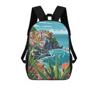
sinyumoney Cinque Terre in Manarola Daypack Casual Backpacks School Bag For Girls Boys High College Teenagers Rucksack Men Women Travel Laptop Rucksack College Bookbag 17inch
£21.97
Amazon-marketplace.co.uk
Delivery from £5.99

sinyumoney Italy Cinque Terre Town Minimalist Art Backpack School High Secondary School Bags Casual Backpack for Teenage Girls Boys Women Men 17inch
£21.97
Amazon-marketplace.co.uk
Delivery from £5.99

Ravensburger Colorful Cinque Terre Puzzle 2000 Pieces Multicolor Kids
£24.49
Kidinn.com (UK)
Delivery from £7.99
Don't forget your voucher code:
Report Illegal Concerns
You are about to report a violation based on the EU Digital Services Act (DSA).