
Moule's County Maps: West of England Including the West Midlands
West of England Including the West Midlands (Moule's county maps)

Cheapest Price
Usually dispatched within 3 to 7 months. Express Delivery available with Amazon Prime.
Direct debit
Direct debit
Visa
Visa
Mastercard
Mastercard
£4.37
Delivery from £2.99
West of England Including the West Midlands (Moule's county maps)

Usually dispatched within 3 to 4 days
Direct debit
Direct debit
Visa
Visa
Mastercard
Mastercard
£4.97
Delivery from £0.99
West of England Including the West Midlands (Moule's county maps)
Cheapest Total Price
Usually dispatched within 5 to 6 days
Direct debit
Direct debit
Visa
Visa
Mastercard
Mastercard
£5.97
Free Delivery
🤖 Ask ChatGPT
💡 Is it worth the price?
🔁 Better alternatives?
⭐ What do users say?
West of England Including the West Midlands (Moule's county maps) - Details
▶ Finding you the best price!
We have found 3 prices for West of England Including the West Midlands (Moule's county maps). Our price list is completely transparent with the cheapest listed first. Additional delivery costs may apply.
West of England Including the West Midlands (Moule's county maps) - Price Information
- Cheapest price: £4.37
- The cheapest price is offered by amazon.co.uk . You can order the product there.
- The price range for the product West of England Including the West Midlands (Moule's county maps) is €£4.37to €£5.97 with a total of 3 offers.
- Payment methods: The online shop amazon.co.uk supports: Direct debit, Visa, Mastercard
- Delivery: The shortest delivery time is Usually dispatched within 3 to 7 months. Express Delivery available with Amazon Prime. working days offered by amazon.co.uk .
Similar products
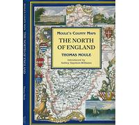
The North of England (Moule's county maps)
£19.99
Amazon-marketplace.co.uk
Free Delivery
Cheapest offer
Pages: 48, Hardcover, Bracken Books
£4.37
Usually dispatched within 3 to 7 months. Express Delivery available with Amazon Prime.
amazon.co.uk
Don't forget your voucher code:
Report Illegal Concerns
You are about to report a violation based on the EU Digital Services Act (DSA).