
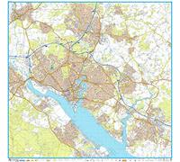
Southampton A-Z Street Atlas : Accurate Street Map for Easy Navigation
Southampton A-Z Street Atlas: Navigate your way around Southampton with ease using trusted mapping

Overall Rating: 2.4 / 5 (average from multiple review sources, as of 8 Jul 2026)
Based on a total of 49,640 customer reviews from independent review platforms.
Sources & Transparency:
The values are derived from publicly available retailer ratings from platforms such as Feefo, http://Reviews.io , Trustpilot, and others, and are aggregated monthly.
All brand names and logos are the property of their respective owners.
Notice:
pricehunter.co.uk cannot guarantee that published shop ratings originate from consumers who have actually made a purchase from the reviewed retailer.
Cheapest Price
In stock. Express Delivery available with Amazon Prime.
Direct debit
Direct debit
Visa
Visa
Mastercard
Mastercard
£8.15
Delivery from £2.99
Southampton A-Z Street Atlas : Navigate Your Way Around Southampton with Ease Using Trusted Mapping

Overall Rating: 4.1 / 5 (average from multiple review sources, as of 30 Jun 2026)
Based on a total of 50,021 customer reviews from independent review platforms.
Sources & Transparency:
The values are derived from publicly available retailer ratings from platforms such as Feefo, http://Reviews.io , Trustpilot, and others, and are aggregated monthly.
All brand names and logos are the property of their respective owners.
Notice:
pricehunter.co.uk cannot guarantee that published shop ratings originate from consumers who have actually made a purchase from the reviewed retailer.
2 - 4 working days
Visa
Visa
Mastercard
Mastercard
£8.54
Delivery from £3.99
Southampton A-Z Street Atlas: Navigate your way around Southampton with ease using trusted mapping

Overall Rating: 1.5 / 5 (average from multiple review sources, as of 27 Jun 2026)
Based on a total of 65 customer reviews from independent review platforms.
Sources & Transparency:
The values are derived from publicly available retailer ratings from platforms such as Feefo, http://Reviews.io , Trustpilot, and others, and are aggregated monthly.
All brand names and logos are the property of their respective owners.
Notice:
pricehunter.co.uk cannot guarantee that published shop ratings originate from consumers who have actually made a purchase from the reviewed retailer.
Usually dispatched within 4 to 5 days
Direct debit
Direct debit
Visa
Visa
Mastercard
Mastercard
£8.63
Delivery from £2.80
Southampton A-Z Street Atlas

Overall Rating: 4.5 / 5 (average from multiple review sources, as of 7 Jul 2026)
Based on a total of 5,480 customer reviews from independent review platforms.
Sources & Transparency:
The values are derived from publicly available retailer ratings from platforms such as Feefo, http://Reviews.io , Trustpilot, and others, and are aggregated monthly.
All brand names and logos are the property of their respective owners.
Notice:
pricehunter.co.uk cannot guarantee that published shop ratings originate from consumers who have actually made a purchase from the reviewed retailer.
3-5 working days
PayPal
PayPal
Visa
Visa
Mastercard
Mastercard
£8.99
Delivery from £3.99
Southampton A-Z Street Atlas: Navigate your way around Southampton with ease using trusted mapping
Overall Rating: 1.5 / 5 (average from multiple review sources, as of 27 Jun 2026)
Based on a total of 65 customer reviews from independent review platforms.
Sources & Transparency:
The values are derived from publicly available retailer ratings from platforms such as Feefo, http://Reviews.io , Trustpilot, and others, and are aggregated monthly.
All brand names and logos are the property of their respective owners.
Notice:
pricehunter.co.uk cannot guarantee that published shop ratings originate from consumers who have actually made a purchase from the reviewed retailer.
Based on a total of 65 customer reviews from independent review platforms.
Sources & Transparency:
The values are derived from publicly available retailer ratings from platforms such as Feefo, http://Reviews.io , Trustpilot, and others, and are aggregated monthly.
All brand names and logos are the property of their respective owners.
Notice:
pricehunter.co.uk cannot guarantee that published shop ratings originate from consumers who have actually made a purchase from the reviewed retailer.
In stock
Direct debit
Direct debit
Visa
Visa
Mastercard
Mastercard
£9.19
Free Delivery
Southampton A-Z Street Atlas: Navigate your way around Southampton with ease using trusted mapping
Overall Rating: 1.5 / 5 (average from multiple review sources, as of 27 Jun 2026)
Based on a total of 65 customer reviews from independent review platforms.
Sources & Transparency:
The values are derived from publicly available retailer ratings from platforms such as Feefo, http://Reviews.io , Trustpilot, and others, and are aggregated monthly.
All brand names and logos are the property of their respective owners.
Notice:
pricehunter.co.uk cannot guarantee that published shop ratings originate from consumers who have actually made a purchase from the reviewed retailer.
Based on a total of 65 customer reviews from independent review platforms.
Sources & Transparency:
The values are derived from publicly available retailer ratings from platforms such as Feefo, http://Reviews.io , Trustpilot, and others, and are aggregated monthly.
All brand names and logos are the property of their respective owners.
Notice:
pricehunter.co.uk cannot guarantee that published shop ratings originate from consumers who have actually made a purchase from the reviewed retailer.
In stock
Direct debit
Direct debit
Visa
Visa
Mastercard
Mastercard
£10.38
Free Delivery
Southampton A-Z Street Atlas: Navigate your way around Southampton with ease using trusted mapping
Overall Rating: 1.5 / 5 (average from multiple review sources, as of 27 Jun 2026)
Based on a total of 65 customer reviews from independent review platforms.
Sources & Transparency:
The values are derived from publicly available retailer ratings from platforms such as Feefo, http://Reviews.io , Trustpilot, and others, and are aggregated monthly.
All brand names and logos are the property of their respective owners.
Notice:
pricehunter.co.uk cannot guarantee that published shop ratings originate from consumers who have actually made a purchase from the reviewed retailer.
Based on a total of 65 customer reviews from independent review platforms.
Sources & Transparency:
The values are derived from publicly available retailer ratings from platforms such as Feefo, http://Reviews.io , Trustpilot, and others, and are aggregated monthly.
All brand names and logos are the property of their respective owners.
Notice:
pricehunter.co.uk cannot guarantee that published shop ratings originate from consumers who have actually made a purchase from the reviewed retailer.
Usually dispatched within 3 to 4 days
Direct debit
Direct debit
Visa
Visa
Mastercard
Mastercard
£11.23
Free Delivery
Southampton A-Z Street Atlas: Navigate your way around Southampton with ease using trusted mapping
Overall Rating: 1.5 / 5 (average from multiple review sources, as of 27 Jun 2026)
Based on a total of 65 customer reviews from independent review platforms.
Sources & Transparency:
The values are derived from publicly available retailer ratings from platforms such as Feefo, http://Reviews.io , Trustpilot, and others, and are aggregated monthly.
All brand names and logos are the property of their respective owners.
Notice:
pricehunter.co.uk cannot guarantee that published shop ratings originate from consumers who have actually made a purchase from the reviewed retailer.
Based on a total of 65 customer reviews from independent review platforms.
Sources & Transparency:
The values are derived from publicly available retailer ratings from platforms such as Feefo, http://Reviews.io , Trustpilot, and others, and are aggregated monthly.
All brand names and logos are the property of their respective owners.
Notice:
pricehunter.co.uk cannot guarantee that published shop ratings originate from consumers who have actually made a purchase from the reviewed retailer.
Usually dispatched within 4 to 5 days
Direct debit
Direct debit
Visa
Visa
Mastercard
Mastercard
£11.24
Free Delivery
Southampton A-Z Street Atlas: Navigate your way around Southampton with ease using trusted mapping
Overall Rating: 1.5 / 5 (average from multiple review sources, as of 27 Jun 2026)
Based on a total of 65 customer reviews from independent review platforms.
Sources & Transparency:
The values are derived from publicly available retailer ratings from platforms such as Feefo, http://Reviews.io , Trustpilot, and others, and are aggregated monthly.
All brand names and logos are the property of their respective owners.
Notice:
pricehunter.co.uk cannot guarantee that published shop ratings originate from consumers who have actually made a purchase from the reviewed retailer.
Based on a total of 65 customer reviews from independent review platforms.
Sources & Transparency:
The values are derived from publicly available retailer ratings from platforms such as Feefo, http://Reviews.io , Trustpilot, and others, and are aggregated monthly.
All brand names and logos are the property of their respective owners.
Notice:
pricehunter.co.uk cannot guarantee that published shop ratings originate from consumers who have actually made a purchase from the reviewed retailer.
Usually dispatched within 4 to 5 days
Direct debit
Direct debit
Visa
Visa
Mastercard
Mastercard
£11.25
Free Delivery
- 1
- 2
- next page
Cheapest offer
Pages: 80, Edition: Tenth edition, Paperback, Geographers’ A-Z Map Co Ltd
£8.15
In stock. Express Delivery available with Amazon Prime.
amazon.co.uk
🤖 Ask ChatGPT
💡 Is it worth the price?
🔁 Better alternatives?
⭐ What do users say?
Southampton A-Z Street Atlas: Navigate your way around Southampton with ease using trusted mapping - Details
▶ Finding you the best price!
We have found 9 prices for Southampton A-Z Street Atlas: Navigate your way around Southampton with ease using trusted mapping. Our price list is completely transparent with the cheapest listed first. Additional delivery costs may apply.
Southampton A-Z Street Atlas: Navigate your way around Southampton with ease using trusted mapping - Price Information
- Cheapest price: £8.15
- The cheapest price is offered by amazon.co.uk. You can order the product there.
- The price range for the product Southampton A-Z Street Atlas: Navigate your way around Southampton with ease using trusted mapping is €£8.15to €£12.98 with a total of 9 offers.
- Payment methods: The online shop amazon.co.uk supports: Direct debit, Visa, Mastercard
- Delivery: The shortest delivery time is In stock. Express Delivery available with Amazon Prime. working days offered by amazon.co.uk.
Similar products
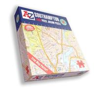
Great Britain A-Z Map of Southampton 1000 Piece Jigsaw Puzzle - Exclusive Street Map - Includes Guide Print & City Index - Nostalgic Gift Mapping Fun for Adults
£19.99
Whsmith.co.uk
Delivery from £3.99

A-Z Southampton Street Map - 41.5" x 40" Paper
£60.99
Amazon-marketplace.co.uk
Delivery from £7.69

Great Britain A Z Map of Southampton 1000 Piece Jigsaw Puzzle Exclusive - Neutral
£19.99
Therange.co.uk
Delivery from £3.95

South East England A-Z Road Atlas
£7.59
Whsmith.co.uk
Delivery from £3.99
Don't forget your voucher code:
Report Illegal Concerns
You are about to report a violation based on the EU Digital Services Act (DSA).