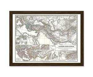
Artery8 Geography Map Illustrated Antique Empire Alexander Great Mediterranean Artwork Framed Wall Art Print A4
£16.49
Amazon-marketplace.co.uk
Free Delivery
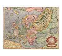
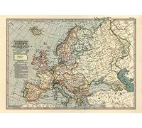
MAPOF ANTIQUE EUROPE EUROPA MERCATOR GEOGRAPHY FINE ART PRINT ART POSTER A4 / A3
£6.99
Amazon-marketplace.co.uk
Free Delivery
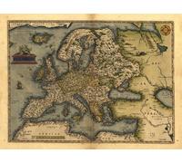
Reproduction Antique Map of Europa, Europe, by Abraham Ortelius A1 Size 78 x 57 cm
£14.99
Amazon-marketplace.co.uk
Free Delivery
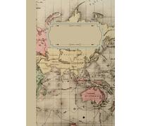
A4 Ruled Notebook with Margin 192 pages: Antique World Map Design, Vintage Notebook, For Students, Writers
£8.39
amazon.co.uk
Delivery from £2.99
Vintage 1897 Historical Antique Art Old Map Of Europe Poster Wall Art A3 & A4 RePrint (A4)
£4.99
Amazon-marketplace.co.uk
Free Delivery

MAPOF ANTIQUE EUROPE EUROPA MERCATOR GEOGRAPHY FINE ART PRINT ART POSTER A4 / A3
£4.99
Amazon-marketplace.co.uk
Free Delivery

The Bible Wheel For Sailors Vintage Illustrated Antique Maps Art Print, Antique Cartographic Map Poster, Old Historical Map Home Decor Wall Art Picture, A2 (Print Only) - 59.4x42cm
£25.00
Amazon-marketplace.co.uk
Free Delivery

Vintage 1780 Historical Antique Old Map Of World Globe Poster Wall Art A3 & A4 RePrint
£4.99
Amazon-marketplace.co.uk
Free Delivery

Reproduction Antique Map of Slavonia: Yugoslavia, Bosnia and Croatia in Europe, by Abraham Ortelius A1 Size
£14.99
Amazon-marketplace.co.uk
Free Delivery

Reproduction Antique Map of Flandria (Flanders is the region overlapping parts of modern France, Belgium and Netherlands), by Abraham Ortelius A1 Size 78 x 57 cm
£14.99
Amazon-marketplace.co.uk
Free Delivery

Large A1 Size (30 x 23 inches) Reproduction Antique 16th Century Map of Northern and Southern Ireland by Abraham Ortelius
£14.99
Amazon-marketplace.co.uk
Free Delivery
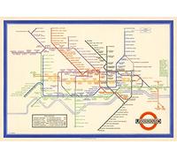
London Underground Poster | Harry Beck's Tube map | Vintage London Print | 1933 | Antique British Map | Retro Subway Map | UK Wall Art (200gsm Satin Paper, A1: 33.1 x 23.4 in)
£29.99
Amazon-marketplace.co.uk
Delivery from £3.00
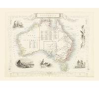
Australia, Reproduction 1851 Antique Map by John Tallis of Australian Territories (New South Wales, Victoria, South & West Australia) (Fine Art Poster, A3+ 19x13 inches (48x33cm))
£9.99
Amazon-marketplace.co.uk
Free Delivery

London subway Underground Poster | Harry Beck's Tube map | Vintage London Print | 1933 | Antique British Map | Retro Subway Map | UK Wall Art (180gsm Matt Paper, A3: 16.5 x 11.7 in)
£15.99
Amazon-marketplace.co.uk
Delivery from £3.00
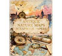
Antique Nature Maps Scrapbook Papers: A Carefully Designed 8.5 × 11 Scrapbook Papers with Over 200 Craft Elements on 35 Pages of Stunning Patterns, Cutouts & Creative Designs
£12.99
amazon.co.uk
Free Delivery

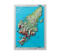
Map of Harris and Lewis 3D Relief Edition, Outer Hebrides | Old Antique Map of Isle of Harris | Old Map Wall Print | Poster Wall Art (200gsm Silk, A2: 23.4 x 16.5in)
£22.99
Amazon-marketplace.co.uk
Delivery from £3.00
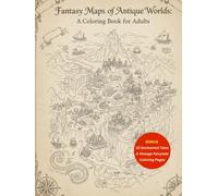
Fantasy Maps of Antique Worlds A Coloring Book for Adults: +100 Old Cartography Lines, Compass Roses & Wanderlust Designs for Relaxation and Stress ... Pages (The Fantasy Cartography Collection)
£16.79
amazon.co.uk
Free Delivery
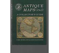
Antique Maps: A Collector's Guide (Christie's collectors guides)
£139.91
Amazon-marketplace.co.uk
Delivery from £2.80

Fantasy Maps of Antique Worlds A Coloring Book for Adults: +100 Old Cartography Lines, Compass Roses & Wanderlust Designs for Relaxation and Stress Relief (8.5x11)
£9.59
amazon.co.uk
Delivery from £2.99

Historic Scottish Map | 1852 | antique wall art | home decor | Scottish Gift l Art Print |Antique maps | Ancient Britain | Vintage Maps (180gsm MATT, 32 x 24 IN)
£29.99
Amazon-marketplace.co.uk
Delivery from £3.00

Fantasy Maps of Antique Worlds A Coloring Book for Adults: 100+ Antique-Style Maps of Mythical Worlds, Lost Civilizations, Hidden Lands & Legendary ... Relief and Imaginative Adventure (8.5x11)
£9.59
amazon.co.uk
Delivery from £2.99

Doppelganger33 LTD Map Antique Moule 1850 Cornwall County Old Large Replica Poster Print
£16.49
Amazon-marketplace.co.uk
Free Delivery
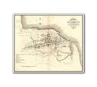
Old Map of St. Andrews, Ancient Scottish Map, Fine Art Print, Antique town survey by John Wood, St Andrews University, Large (200gsm Silk, 24 x 20 inches)
£19.99
Amazon-marketplace.co.uk
Delivery from £3.00

Aston Villa History of The Beautiful Name - Celebrating the 150th Anniversary of the Founding of the Football Club 1874-2024 : Supplied in a Clear Split Screw Type Tube - Print Size 24" x 16" (61cm x
£28.49
Whsmith.co.uk
Free Delivery

National Geographic World Executive Wall Map - Antique Style - 36 x 24 inches - Art Quality Print
£23.99
Amazon-marketplace.co.uk
Free Delivery

A Middlesex 1611 - 1836 - Fold Up Map that features a collection of Four Historic Maps, John Speed’s County Map 1611, Johan Blaeu’s County Map of 1648, Thomas Moules County Map of 1836 and a Map of th
£18.99
Whsmith.co.uk
Delivery from £3.99
Map of Harris and Lewis 3D Relief Edition, Outer Hebrides | Old Antique Map of Isle of Harris | Old Map Wall Print | Poster Wall Art (180gsm Matt, A2: 23.4 x 16.5in)
£22.99
Amazon-marketplace.co.uk
Delivery from £3.00

Devon 1611 - 1836 - Fold Up Map that features a collection of Four Historic Maps, John Speed's County Map 1611, Johan Blaeu's County Map of 1648, Thomas Moules County Map of 1836 and a Plan of Exeter
£18.99
Whsmith.co.uk
Delivery from £3.99

Doppelganger33 LTD Map Reproduction Antique Roman Empire 69 Ad Bartholomew Rome Extra Large Art Print Poster
£16.49
Amazon-marketplace.co.uk
Free Delivery

Urbano Monte World Map 1587 - Rare Antique Planisphere Print, Vintage Historical Map Wall Art 36in x 36in
£61.66
Amazon-marketplace.co.uk
Delivery from £10.73

Gloucestershire 1611 - 1836 - Fold Up Map that features a collection of Four Historic Maps, John Speed's County Map 1611, Johan Blaeu's County Map of 1648, Thomas Moules County Map of 1836 and a Plan
£18.99
Whsmith.co.uk
Delivery from £3.99
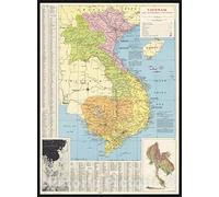
Historic Pictoric Map : Vietnam 1965, Vietnam and neighboring countries, Antique Vintage Reproduction : 24in x 30in
£47.99
Amazon-marketplace.co.uk
Delivery from £9.32

A Cheshire 1611 - 1840 - Fold Up Map that features a collection of Four Historic Maps, John Speed's County Map 1611, Johan Blaeu's County Map of 1648, Thomas Moules County Map of 1840 and Cole and Rop
£18.99
Whsmith.co.uk
Delivery from £3.99

New Plan Of London Vintage Illustrated Antique Maps Art Print, Antique Cartographic Map Poster, Old Historical Map Home Decor Wall Art Picture, A4 (Print Only) - 29.7x21cm
£12.00
Amazon-marketplace.co.uk
Free Delivery

A Oxfordshire 1611 - 1836 - Fold Up Map that features a collection of Four Historic Maps, John Speed's County Map 1611, Johan Blaeu's County Map of 1648, Thomas Moules County Map of 1836 and a Plan of
£18.99
Whsmith.co.uk
Delivery from £3.99

Historic Pictoric Map : Vietnam 1965, Vietnam and neighboring countries, Antique Vintage Reproduction : 18in x 24in
£34.36
Amazon-marketplace.co.uk
Delivery from £9.32

Map of Harris and Lewis 3D Relief Edition, Outer Hebrides | Old Antique Map of Isle of Harris | Old Map Wall Print | Poster Wall Art (200gsm Silk, 32 x 24in)
£29.99
Amazon-marketplace.co.uk
Delivery from £3.00
Old Isle of Mull Map | Mvla Insvla | Old Antique Map | 1665 | Blaeu Map | Tobermory, Kilchoan, Kintyre, Craignure, Calgary, Salen (200gsm Silk, 24 x 18in)
£22.99
Amazon-marketplace.co.uk
Delivery from £3.00

Historical Map, 1873 Map of Palestine and all Bible lands, containing the ancient and modern names of all known places, a table of seasons, weather, productions, etc, Vintage Wall Art : 18in x 24in
£35.09
Amazon-marketplace.co.uk
Delivery from £9.32
- 1
- 2
- 3
- 4
- 5
- next page
🤖 Ask ChatGPT
🛍️ What are the most important purchase criteria?
💰 Tell me the best deals!
📋 Create a short summary!
Informations about "antique maps: a"
With Pricehunter, you can compare prices of sale online in order to find the bid that most fulfills your requirements "antique maps: a".
Based on your search criteria "antique maps: a", our price search engine found the lowest prices in 10 categories.
About "antique maps: a"
- Lowest prices found in 3 different mail order companies, including Amazon-marketplace.co.uk, amazon.co.uk and Whsmith.co.uk.
- If you would prefer an item from a particular manufacturers, you can find 9 online stores for this product. If you have not yet made a decision, you can also filter your favourite manufacturers and choose between 9 manufacturers.
- 9 different manufacturers offer the product - Generic Sports, Trefl, Ofa Bamberg and Educa Borrás, that you were looking for.
- Furthermore, other clients researched for the following product .
- With Pricehunter you are also spoilt for choice for colours. You can select your favourite from 0 coloration. The article is most commonly ordered in the colour .
Don't forget your voucher code:
Report Illegal Concerns
You are about to report a violation based on the EU Digital Services Act (DSA).