
Monsal Trail Then and Now: & The Railway from Matlock to Buxton
£9.55
Amazon-marketplace.co.uk
Delivery from £3.20

Then & Now The Monsal Trail: & The Railway from Matlock to Buxton
£12.99
amazon.co.uk
Free Delivery
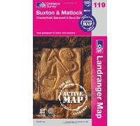
Ordnance Survey Landranger Active 119 Buxton & Matlock, Chesterfield, Bakewell & Dove Dale Map With Digital Version One Size
£10.20
Blacks.co.uk
Delivery from £4.99

From Horseshoe to Harper Hill: 750 Mid-grade Sport Climbs in the Buxton and Matlock Area
£14.00
Amazon-marketplace.co.uk
Delivery from £2.00
Buxton and Matlock: Sheet 119 (Cassini Revised New Series Historical Map)
£3.95
Amazon-marketplace.co.uk
Delivery from £2.18

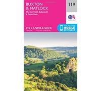
Buxton and Matlock, Chesterfield, Bakewell and Dove Dale: Sheet 119 (OS Landranger Map)
£12.99
Amazon-marketplace.co.uk
Delivery from £2.80
Ordnance Survey Landranger 119 Buxton, Matlock, Bakewell & Dove Dale Map With Digital Version One Size
£7.80
Blacks.co.uk
Delivery from £4.99
Buxton and Matlock, Chesterfield, Bakewell and Dove Dale: Sheet 119 (OS Landranger Active Map)
£17.95
Amazon-marketplace.co.uk
Delivery from £2.80
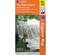
The Peak District (OS Explorer Map): White Peak area. Buxton, Bakewell, Matlock & Dove Dale. Showing part of the Peak National Park, Pennine Bridleway, High Peak Trail and Tissington Trail by Ordnance Survey (2009) Paperback
£12.99
Amazon-marketplace.co.uk
Delivery from £2.80

The Peak District (OS Explorer Map): White Peak area. Buxton, Bakewell, Matlock & Dove Dale. Showing part of the Peak National Park, Pennine Bridleway, High Peak Trail and Tissington Trail by Ordnance Survey (2009) Paperback
£19.05
Amazon-marketplace.co.uk
Free Delivery

Landranger (119) Buxton & Matlock, Chesterfield, Bakewell & Dove Dale (OS Landranger Map) by Ordnance Survey (2016-02-24)
£23.26
Amazon-marketplace.co.uk
Free Delivery

The Peak District (OS Explorer Map): White Peak area. Buxton, Bakewell, Matlock & Dove Dale. Showing part of the Peak National Park, Pennine Bridleway, High Peak Trail and Tissington Trail by Ordnance Survey (2009) Paperback
£19.04
Amazon-marketplace.co.uk
Free Delivery

The Peak District (OS Explorer Map): White Peak area. Buxton, Bakewell, Matlock & Dove Dale. Showing part of the Peak National Park, Pennine Bridleway, High Peak Trail and Tissington Trail by Ordnance Survey (2009) Paperback
£19.03
Amazon-marketplace.co.uk
Free Delivery
Landranger (119) Buxton & Matlock, Chesterfield, Bakewell & Dove Dale (OS Landranger Map) by Ordnance Survey (2016-02-24)
£15.32
Amazon-marketplace.co.uk
Delivery from £7.95
🤖 Ask ChatGPT
🛍️ What are the most important purchase criteria?
💰 Tell me the best deals!
📋 Create a short summary!
Informations about "buxton and matlock:"
Compare 54 offers for your search.
Pricehunter was able to locate products in 3 categories, ranging from £3.95 to £23.26.
About "buxton and matlock:"
- In total, Pricehunter was able to locate 5 offers, from web-shops such as Amazon-marketplace.co.uk, amazon.co.uk, Whsmith.co.uk and Millets.co.uk.
- After having chosen your supplier you may also choose the delivery company. 1 delivery companies are available createspace being the most popular.
- The most offers (9) were found in the price range from £12.00 to £12.99.
- Customers who looked for this item also found interesting.
- With our extensive colour palette you can select your favourite colour for your article. Of the available 0 shades is the most frequently chosen.
Don't forget your voucher code:
Report Illegal Concerns
You are about to report a violation based on the EU Digital Services Act (DSA).