£9.95
amazon.co.uk
Delivery from £2.99

£12.55
amazon.co.uk
Free Delivery
£12.99
Amazon-marketplace.co.uk
Delivery from £3.97
£14.05
Amazon-marketplace.co.uk
Delivery from £2.80
£13.75
amazon.co.uk
Free Delivery

£58.00
amazon.co.uk
Free Delivery
£31.16
Amazon-marketplace.co.uk
Free Delivery

£13.55
amazon.co.uk
Free Delivery
£8.64
Amazon-marketplace.co.uk
Delivery from £2.80
£5.69
Amazon-marketplace.co.uk
Delivery from £2.65

£11.33
Amazon-marketplace.co.uk
Delivery from £2.80
£15.81
Amazon-marketplace.co.uk
Delivery from £2.80
£8.99
amazon.co.uk
Delivery from £2.99

£14.98
amazon.co.uk
Free Delivery

£14.74
amazon.co.uk
Free Delivery

£26.78
Amazon-marketplace.co.uk
Delivery from £7.74

£14.99
amazon.co.uk
Free Delivery

£7.80
Millets.co.uk
Delivery from £3.99
£14.99
amazon.co.uk
Free Delivery
£9.45
Amazon-marketplace.co.uk
Delivery from £2.80
£25.87
Amazon-marketplace.co.uk
Free Delivery

£54.34
Amazon-marketplace.co.uk
Delivery from £2.80
£7.81
Amazon-marketplace.co.uk
Free Delivery

The Great Book of DELAWARE: Incredible History, Wild Facts, and the Spirit That Shaped America
£15.70
amazon.co.uk
Free Delivery
£11.66
Amazon-marketplace.co.uk
Delivery from £2.00

£7.80
Blacks.co.uk
Delivery from £4.99

Historical Atlas of the Great Khans: Mongol Wars and Conquests, 1160-1304
£32.09
amazon.co.uk
Free Delivery

£17.86
Amazon-marketplace.co.uk
Free Delivery
Northumberland Notebook: 120 page lined 6"x9" white pages. Ordnance Survey Map on front and back cover. Great gift idea for someone who loves the outdoors, walking, national parks, and exploring.
£7.79
amazon.co.uk
Delivery from £2.99

£71.95
Amazon-marketplace.co.uk
Free Delivery

£30.95
amazon.co.uk
Free Delivery
£12.99
amazon.co.uk
Free Delivery
£11.63
Amazon-marketplace.co.uk
Delivery from £2.80

£24.55
Amazon-marketplace.co.uk
Delivery from £4.99

17 Walks in Venice, Italy: Find your way in one of the world's great cities
£16.95
amazon.co.uk
Free Delivery

UK National Park Wall Map - The Yorkshire Dales - Large 120cm X 150cm Wall Map - Ordnance Survey Landranger Base, Great For Walkers, Adventures, Explorers And Outdoor Enthusiasts
£22.99
Amazon-marketplace.co.uk
Free Delivery

£15.99
amazon.co.uk
Free Delivery
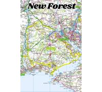
New Forest Notebook: 120 page lined 6"x9" white pages. Ordnance Survey Map on front and back cover. Great gift idea for someone who loves the outdoors, walking, national parks, and exploring.
£7.79
amazon.co.uk
Delivery from £2.99
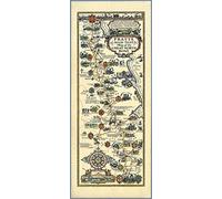
1930 - Pratts High Test Map of the Great North Road by Alfred E. Taylor - Size 33 x 80 cm - Paper
£14.69
Amazon-marketplace.co.uk
Delivery from £4.00

The Great Lakes Mega Road Atlas 2026-2027: Complete Scenic Routes, Cross-Border Highways, Detailed City Maps, and Essential Travel Planning Across the Great Lakes Region
£29.42
amazon.co.uk
Free Delivery
- 1
- 2
- 3
- 4
- 5
- next page
🤖 Ask ChatGPT
🛍️ What are the most important purchase criteria?
💰 Tell me the best deals!
📋 Create a short summary!
Informations about "great maps: the"
With Pricehunter, you can compare offers online in order to find the bid that most fulfills your requirements "great maps: the".
Based on your search criteria "great maps: the", our price search engine found the lowest prices in 50 categories.
About "great maps: the"
- Lowest prices found in 15 different mail order companies, including Millets.co.uk, themountainedge.com, debenhams.com and Diy.com (B&Q).
- If you would prefer an item from a particular brands, you can find 14 online shops for this product. If you have not yet made a decision, you can also filter your favourite manufacturers and choose between 14 manufacturers.
- 14 different brands offer the product - Lonely Planet, National Geographic, Generic Sports and The AA, that you were looking for.
- Furthermore, other clients researched for the following product .
- With Pricehunter you are also spoilt for choice for colours. You can select your favourite from 100 coloration. The article is most commonly ordered in the colour Multi-coloured.
Don't forget your voucher code:
Report Illegal Concerns
You are about to report a violation based on the EU Digital Services Act (DSA).