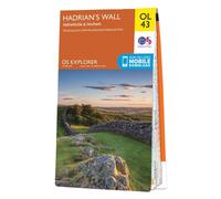

Hadrian's Wall: Sheet OL43 (OS Explorer Map Active)
£17.95
Amazon-marketplace.co.uk
Free Delivery
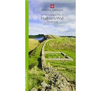
By Author An Archaeological Map of Hadrian's Wall: 1:25000 Scale (Revised edition)
£33.90
Amazon-marketplace.co.uk
Free Delivery
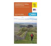
Ordnance Survey Explorer OL43 Hadrian's Wall Map With Digital Version One Size
£7.80
Millets.co.uk
Delivery from £3.99

Hadrian's Wall: Sheet OL43 (OS Explorer Map)
£12.99
Amazon-marketplace.co.uk
Free Delivery
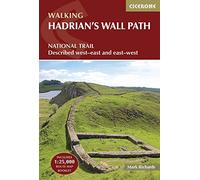

Harvey National Trail Map ~ Hadrian's Wall Path
£16.50
Amazon-marketplace.co.uk
Free Delivery
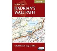
Hadrian's Wall Map | Pocket-sized 1:25,000 OS Route Map (Cicerone National Trail Maps)
£10.95
amazon.co.uk
Free Delivery


Hadrian's Wall Path Trail Map (4009) : Trails Illustrated
£14.95
Whsmith.co.uk
Delivery from £3.99


Hadrian's Wall - Visitor Map and Guide: An illustrated fold-out map and short history
£4.74
amazon.co.uk
Free Delivery

Hadrian's Wall Path: with Ordnance Survey mapping (A -Z Adventure Series)
£11.39
amazon.co.uk
Free Delivery

The Roman Empire at Its Height in AD 117 - Large Illustrated Historical Wall Map with the Provinces, Cities, Emperors and Timeline of Rome - 70 × 100 cm
£43.99
Amazon-marketplace.co.uk
Free Delivery


The Roman Empire at Its Height in AD 117 - Large Illustrated Historical Wall Map with the Provinces, Cities, Emperors and Timeline of Rome - 59.4 × 84.1 cm
£33.99
Amazon-marketplace.co.uk
Free Delivery

Durham England Travel Guide 2027: Explore the UNESCO Cathedral and Castle, with Itineraries, Christmas Markets, QR Code Map Links and Day Trips to Beamish and Hadrian’s Wall
£14.27
amazon.co.uk
Free Delivery

The Roman Empire at Its Height in AD 117 - Large Illustrated Historical Wall Map with the Provinces, Cities, Emperors and Timeline of Rome - 29.7 × 42 cm
£19.99
Amazon-marketplace.co.uk
Free Delivery
Ordnance Survey Landranger 85 Carlisle & Solway Firth, Gretna Green Map With Digital Version One Size
£7.80
Blacks.co.uk
Delivery from £4.99

Sycamore Gap Picture Wall Art | Hadrian’s Wall Print | Poster Unframed (A4)
£7.99
Amazon-marketplace.co.uk
Delivery from £5.61

Ordnance Survey Landranger 88 Newcastle upon Tyne, Durham & Sunderland Map With Digital Version One Size
£7.80
Millets.co.uk
Delivery from £3.99

The Roman Empire at Its Height in AD 117 - Large Illustrated Historical Wall Map with the Provinces, Cities, Emperors and Timeline of Rome - 42 × 59.4 cm
£25.99
Amazon-marketplace.co.uk
Free Delivery
Ordnance Survey Explorer 314 Solway Firth Map With Digital Version One Size
£7.80
Millets.co.uk
Delivery from £3.99

Hadrian's Wall (OS Explorer Map) by Ordnance Survey (November 30, 2009) Paperback
£12.99
Amazon-marketplace.co.uk
Free Delivery
Ordnance Survey Landranger 87 Hexham & Haltwhistle Map With Digital Version One Size
£7.80
Blacks.co.uk
Delivery from £4.99

Hexham and Haltwhistle: No. 87 (Cassini Old Series Historical Map)
£10.99
Amazon-marketplace.co.uk
Free Delivery
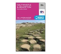
Ordnance Survey Landranger 86 Haltwhistle & Brampton, Bewcastle & Alston Map With Digital Version One Size
£7.80
Millets.co.uk
Delivery from £3.99

Sycamore Gap Picture Wall Art | Hadrian’s Wall Print | Poster Unframed (A3)
£12.99
Amazon-marketplace.co.uk
Delivery from £5.61

Ordnance Survey Landranger Map 085 Carlisle & Solway Firth, Gretna
£9.99
outdooraction.co.uk
Delivery from £2.50
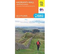
OS Explorer OL43 Hadrian's Wall (OS Explorer Map) by Ordnance Survey (2015-06-10)
£56.88
Amazon-marketplace.co.uk
Free Delivery

Ordnance Survey Landranger Map 86 Haltwhistle & Brampton, Bewcastl
£9.99
outdooraction.co.uk
Delivery from £2.50

Hadrian's Wall, Haltwhistle & Hexham: OL 43 (OS Explorer Map)
£17.95
Amazon-marketplace.co.uk
Free Delivery

Philip's Navigator Britain: the Champion of Road Atlases
£26.99
Whsmith.co.uk
Free Delivery

The Roman Empire at Its Height in AD 117 - Large Illustrated Historical Wall Map with the Provinces, Cities, Emperors and Timeline of Rome - 50 × 70 cm
£29.99
Amazon-marketplace.co.uk
Free Delivery

Philip's Navigator Britain: Spiral
£26.99
Whsmith.co.uk
Free Delivery

Brightcore Roman Roads Tube Map Ceramic Coffee Mug, 11oz, 9.5cm H x 8.5cm D
£11.99
Amazon-marketplace.co.uk
Delivery from £8.99

Philip's Navigator Britain: the Champion of Road Atlases : Special Lie-flat Edition
£24.99
Whsmith.co.uk
Delivery from £3.99

Hadrian's Wall : History and Guide
£18.99
Whsmith.co.uk
Delivery from £3.99
- 1
- 2
- next page
🤖 Ask ChatGPT
🛍️ What are the most important purchase criteria?
💰 Tell me the best deals!
📋 Create a short summary!
Informations about "hadrian’s wall map"
Compare 64 bids for your search.
Pricehunter was able to locate products in 18 categories, ranging from £4.74 to £56.88.
About "hadrian’s wall map"
- In total, Pricehunter was able to locate 7 proposals, from providers such as Amazon-marketplace.co.uk, Whsmith.co.uk, amazon.co.uk and Millets.co.uk.
- If you prefer a particular brand, you can compare products from 3 brands. You can also filter your favourite manufacturers and choose from Harper Collins Publishers, Generic Sports and Collins.
- The most bids (13) were found in the price range from £7.00 to £7.99.
- Customers who looked for this item also found interesting.
- With our extensive colour palette you can select your favourite colour for your article. Of the available 0 coloration is the most frequently chosen.
Don't forget your voucher code:
Report illegal content
You are about to report a violation based on the EU Digital Services Act (DSA).