![Asia Classic Map [Laminated] - Reference Map: Wall Maps Continents (National Geographic Reference Map)](https://cdn.pricehunter.co.uk/offer/en/asia-classic-map-laminated-reference-map-wall-maps-continents-national-geographic-reference-map-200t1809a658bac0b383e0c0910ebdcdddb28bf2daf3b73.jpg)
£26.63
Amazon-marketplace.co.uk
Delivery from £2.80
£28.33
Amazon-marketplace.co.uk
Delivery from £6.47

Artery8 World Map With Landmarks And Animals XL Giant Panel Poster (8 Sections)
£14.99
Amazon-marketplace.co.uk
Free Delivery

£9.66
amazon.co.uk
Delivery from £2.99

British Islands Geology Map Print - 2D Giclée Elevation Map
£28.00
Amazon-marketplace.co.uk
Delivery from £3.00

Scotland Map - Geological Print - Vintage - 1912 - Geology - 3D shaded effect relief Poster - Elevation Map - Scottish Art - 2D Giclée Art (200gsm Satin, 24 x 18 inches)
£24.99
Amazon-marketplace.co.uk
Delivery from £3.00

Stukk Map of Europe Wall Art Poster - A1 (594 x 841mm),white
£15.99
Amazon-marketplace.co.uk
Free Delivery

National Geographic: Atlantic Ocean 1968 - Historic Wall Map Series - 19 x 25 inches - Laminated
£25.99
Amazon-marketplace.co.uk
Delivery from £7.69

National Geographic: The Two Koreas 2003 - Historic Wall Map Series - 20 x 31 inches - Laminated
£35.99
Amazon-marketplace.co.uk
Delivery from £7.69

National Geographic: World War 2 - Germany and Its Approaches 1938-1939 - Historic Wall Map Series - 33.5 x 26.25 inches - Laminated
£35.99
Amazon-marketplace.co.uk
Delivery from £7.69
National Geographic: Mediterranean Region Wall Map - 28 x 22 inches - Laminated
£35.99
Amazon-marketplace.co.uk
Delivery from £7.69
National Geographic: Korea and Manchuria 1904 - Historic Wall Map Series - 35 x 42.75 inches - Laminated
£63.99
Amazon-marketplace.co.uk
Delivery from £7.69

National Geographic: Africa Wall Map, A Storied Landscape - 24.25 x 22.25 inches - Laminated
£25.99
Amazon-marketplace.co.uk
Delivery from £7.69

Laminated Posters HUGE LAMINATED/ENCAPSULATED Map Of The UK British Isles GB Road Map POSTER Measures 36 x 24 inches (91.5 x 61 cm)
£15.99
Amazon-marketplace.co.uk
Delivery from £6.00
Old Edinburgh Map by Tallis & Rapkin | Plan of the City of Edinburgh, Scotland | 1851 | Vintage Scottish Print | Old Map Wall Decor (180gsm Matt Paper, 24 x 18 in)
£23.99
Amazon-marketplace.co.uk
Delivery from £3.00

National Geographic: Indonesia 1996 - Historic Wall Map Series - 31 x 20.25 inches - Laminated
£35.99
Amazon-marketplace.co.uk
Delivery from £7.69

Scratch off World Map with Gift Tube,42.3 x 30cm Small Scratchable Travel Map, Black with Golden foil Scratch World Map for travellers
£9.99
Amazon-marketplace.co.uk
Delivery from £4.49
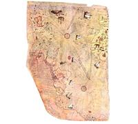
Piri Reis Map, Old classic Map of Piri Reis Poster Print Wall Art Image Home Decor Artworks in Different Sizes
£16.99
Amazon-marketplace.co.uk
Free Delivery
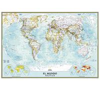
National Geographic Spanish World Classic Wall Map, Mapa Mural Del Mundo Español - 39.25 x 27 inches - Laminated
£35.99
Amazon-marketplace.co.uk
Delivery from £7.69

National Geographic: A Travelers' Wall Map of the West Indies - 36.25 x 23.5 inches - Laminated
£35.99
Amazon-marketplace.co.uk
Delivery from £7.69
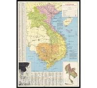
Historic Pictoric Map : Vietnam 1965, Vietnam and neighboring countries, Antique Vintage Reproduction : 24in x 30in
£45.96
Amazon-marketplace.co.uk
Delivery from £9.32

Old Map of Iceland - Topological Nordic Print - Reykjavik - Keflavik - Geysir -Gulfoss - Volcanoes - Glaciers - Samuel Eggertsson - 1928 (200gsm Silk, A2: 23.4 x 16.5in)
£22.99
Amazon-marketplace.co.uk
Delivery from £3.50
National Geographic: The Arctic - North Pole 1965 - Historic Wall Map Series - 25 x 19 inches - Laminated
£25.99
Amazon-marketplace.co.uk
Delivery from £7.69
HUGE LAMINATED/ENCAPSULATED Europe 2009 Edition Road Map With European E.U Flags Educational POSTER measures 36 x 24 inches (91.5 x 61cm)
£13.99
Amazon-marketplace.co.uk
Delivery from £6.00

Scotland Map - Geological Print - Vintage - 1912 - Geology - 3D shaded effect relief Poster - Elevation Map - Scottish Art - 2D Giclée Art (180gsm Matt, A2: 23.4 x 16.5 inches)
£24.99
Amazon-marketplace.co.uk
Delivery from £3.00

National Geographic: Europe 1915 World War 1 - Historic Wall Map Series - 31.5 x 28.5 inches - Laminated
£30.99
Amazon-marketplace.co.uk
Free Delivery
National Geographic: Scandinavia 1963 - Historic Wall Map Series - 19 x 24.75 inches - Laminated
£25.99
Amazon-marketplace.co.uk
Delivery from £7.69

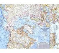
National Geographic Maps: World Contemporary Wall Map - Compact - 23.25 x 16 in - Laminated
£17.59
Amazon-marketplace.co.uk
Delivery from £4.49

Aberdeen Map | Old Map of the City of Aberdeen, Scotland | 1851 | Vintage Scottish Print | Old Map Wall Decor (180gsm Matt Paper, 32 x 24 in)
£29.99
Amazon-marketplace.co.uk
Delivery from £3.00

Old Map of Iceland - Topological Nordic Print - Reykjavik - Keflavik - Geysir -Gulfoss - Volcanoes - Glaciers - Samuel Eggertsson - 1928 (180gsm Matt, A2: 23.4 x 16.5in)
£22.99
Amazon-marketplace.co.uk
Delivery from £3.50
Old Map of Iceland - Topological Nordic Print - Reykjavik - Keflavik - Geysir -Gulfoss - Volcanoes - Glaciers - Samuel Eggertsson - 1928 (200gsm Silk, A0: 46.8 x 33.1in)
£39.99
Amazon-marketplace.co.uk
Delivery from £3.50
Maps International Wall Map of Germany - Classic Poster - 84cm (w) x 118.9cm (h)
£16.99
Amazon-marketplace.co.uk
Delivery from £4.49

Piri Reis Map, Old classic Map of Piri Reis Poster Print Wall Art Image Home Decor Artworks in Different Sizes
£19.99
Amazon-marketplace.co.uk
Free Delivery

Old Map of Iceland - Topological Nordic Print - Reykjavik - Keflavik - Geysir -Gulfoss - Volcanoes - Glaciers - Samuel Eggertsson - 1928 (180gsm Matt, A1: 33.1 x 23.4in)
£29.99
Amazon-marketplace.co.uk
Delivery from £3.50

National Geographic: England and Wales Wall Map - 21 x 27 inches - Laminated
£35.99
Amazon-marketplace.co.uk
Delivery from £7.69
Map of Harris and Lewis 3D Relief Edition, Outer Hebrides | Old Antique Map of Isle of Harris | Old Map Wall Print | Poster Wall Art (200gsm Silk, A2: 23.4 x 16.5in)
£22.99
Amazon-marketplace.co.uk
Delivery from £3.00

London Underground Poster | Harry Beck's Tube map | Vintage London Print | 1933 | Antique British Map | Retro Subway Map | UK Wall Art (180gsm Matt Paper, A1: 33.1 x 23.4 in)
£29.99
Amazon-marketplace.co.uk
Delivery from £3.00

National Geographic: Union of Soviet Socialist Republics 1938-1944 - Historic Wall Map Series - 40.5 x 25.75 inches - Laminated
£35.99
Amazon-marketplace.co.uk
Delivery from £7.69

National Geographic: Europe and the Near East 1940 World War 2 - Historic Wall Map Series - 38.75 x 34 inches - Laminated
£63.99
Amazon-marketplace.co.uk
Delivery from £7.69

National Geographic: The Canada/US Great Lakes 1987 - Historic Wall Map Series - 27.25 x 20.5 inches - Laminated
£35.99
Amazon-marketplace.co.uk
Delivery from £7.69
- 1
- 2
- 3
- 4
- 5
- next page
🤖 Ask ChatGPT
🛍️ What are the most important purchase criteria?
💰 Tell me the best deals!
📋 Create a short summary!
Informations about "maps for when"
Having searched the market for the cheapest prices of sale, 1,068 bids were found for comparison.
Furthermore, a large number of products in 29 relevant categories with a price range from £1.97 to £1,285.46 were found.
About "maps for when"
- Overall, our search showed 15 different online stores for your product "maps for when", including Amazon-marketplace.co.uk, amazon.co.uk, waterstones.com and fruugo.co.uk.
- After having chosen your brands you may also choose the delivery company. 14 delivery brands are available Garmin, TomTom, National Geographic and Amazfit being the most popular.
- The most bids (137) were found in the price range from £13.00 to £13.99.
- Furthermore, other users were also interested in the following product: .
- Personalise your product by choosing one of the 0 shades.
Don't forget your voucher code:
Report Illegal Concerns
You are about to report a violation based on the EU Digital Services Act (DSA).