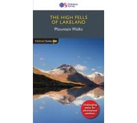
Ordnance Survey - High Fells of Lakeland - Pathfinder 69: 24 Mountain Walks (Pathfinder Guides)
£10.86
Amazon-marketplace.co.uk
Delivery from £2.80
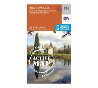
Ordnance Survey Explorer Active 136 High Weald & Royal Tunbridge Wells Map With Digital Version One Size
£10.20
Blacks.co.uk
Delivery from £4.99
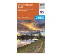
Ordnance Survey Explorer 172 Chiltern Hills East Map With Digital Version one size
£7.80
Blacks.co.uk
Delivery from £4.99
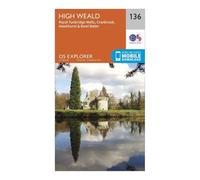
Ordnance Survey Explorer 136 High Weald Map With Digital Version One Size
£7.80
Millets.co.uk
Delivery from £3.99
Ordnance Survey Explorer Active 172 Chiltern Hills East Map With Digital Version One Size
£10.20
Blacks.co.uk
Delivery from £4.99
Ordnance Survey Explorer Map 136 High Weald, Royal Tunbridge Wells
£12.99
Amazon-marketplace.co.uk
Delivery from £2.80
The High Peak 1906: One Inch Sheet 099 (Old Ordnance Survey Maps - Inch to the Mile)
£3.75
Amazon-marketplace.co.uk
Delivery from £2.80

Artery8 Map Ordnance Survey 1959 Lorn Lochaber Scotland Large Wall Art Poster Print Thick Paper 18X24 Inch
£14.49
amazon.co.uk
Delivery from £4.49

High Wycombe 1923: Buckinghamshire Sheet 47.01b (Old Ordnance Survey Maps of Buckinghamshire)
£3.75
Amazon-marketplace.co.uk
Delivery from £2.80

Artery8 Map Ordnance Survey 1959 Lorn Lochaber Scotland Premium Wall Art Canvas Print 18X24 Inch
£17.49
amazon.co.uk
Delivery from £4.49
High Heaton & Jesmond Dene 1913: Tyneside Sheet 5b (Old Ordnance Survey Maps of Tyneside)
£3.75
Amazon-marketplace.co.uk
Delivery from £2.80

Artery8 Map Ordnance Survey 1959 Lorn Lochaber Scotland Unframed Wall Art Print Poster Home Decor Premium
£10.99
amazon.co.uk
Delivery from £4.49
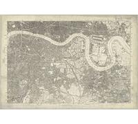
I MAPS 1872 Map of South East London - Ordnance Survey 1:10,560 Scale - Size - 90 x 62cm - Paper
£13.64
Amazon-marketplace.co.uk
Delivery from £4.00
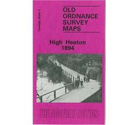
High Heaton 1894: Tyneside Sheet 5 (Old Ordnance Survey Maps of Tyneside)
£3.75
Amazon-marketplace.co.uk
Delivery from £2.80
Artery8 Map Ordnance Survey 1959 Lorn Lochaber Scotland Art Print Canvas Premium Wall Decor Poster Mural
£12.99
amazon.co.uk
Delivery from £4.49

Brighton & Eastbourne - Ordnance Survey of England and Wales 1920 Series - Size - 100 x 73cm - Paper
£17.84
Amazon-marketplace.co.uk
Delivery from £4.00

Ordnance Survey Explorer Map OL47 Crieff, Comrie & Glen Artney
£9.99
outdooraction.co.uk
Delivery from £2.50

High Lane (North) 1907: Cheshire Sheet 20.09 (Old Ordnance Survey Maps of Cheshire)
£3.75
Amazon-marketplace.co.uk
Delivery from £2.80

I MAPS 1872 Ordnance Survey Map of London - Islington (Sheet XVII) - Paper Laminated (A2)
£14.60
Amazon-marketplace.co.uk
Delivery from £4.00

Lifeventure Soft Fibre Ordnance Survey Travel Giant Towel Beige 150 x 90 cm
£22.49
Traininn.com (UK)
Delivery from £4.99

Preston and Environs - Ordnance Survey of England and Wales 1870 Series - Size A2-59.4 x 42cm - Paper Laminated
£13.64
Amazon-marketplace.co.uk
Delivery from £4.00
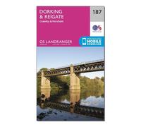
Ordnance Survey Landranger 187 Dorking, Reigate & Crawley Map With Digital Version One Size
£7.80
Millets.co.uk
Delivery from £3.99

Isles of Scilly - Ordnance Survey of England and Wales 1890 Series - Size - 100 x 74cm - Paper
£19.11
Amazon-marketplace.co.uk
Delivery from £4.00
Ordnance Survey Landranger 175 Reading, Windsor, Henley-on-Thames & Bracknell Map With Digital Version One Size
£7.80
Millets.co.uk
Delivery from £3.99

Bolton & Manchester - Ordnance Survey of England and Wales 1920 Series - Size - 100 x 73cm - Paper
£17.84
Amazon-marketplace.co.uk
Delivery from £4.00
Ordnance Survey Landranger 119 Buxton, Matlock, Bakewell & Dove Dale Map With Digital Version One Size
£7.80
Blacks.co.uk
Delivery from £4.99

Mouth of the Humber - Ordnance Survey of England and Wales 1920 Series - Size 73 x 100 cm - Paper
£19.11
Amazon-marketplace.co.uk
Delivery from £4.00

Ordnance Survey Landranger 198 Brighton & Lewes, Haywards Heath Map With Digital Version One Size
£7.80
Millets.co.uk
Delivery from £3.99

Wells next to the Sea - Ordnance Survey of England and Wales 1890 Series - Size - 100 x 74cm - Paper
£19.11
Amazon-marketplace.co.uk
Delivery from £4.00
Ordnance Survey Explorer 124 Hastings & Bexhill Map With Digital Version One Size
£7.80
Millets.co.uk
Delivery from £3.99

Butler and Hill Personalised Map Tea Towel - Custom Ordnance Survey or London Street Map - 100% Cotton Kitchen Towel - Unique Housewarming & Gift Idea (73 x 47 cm)
£39.99
Amazon-marketplace.co.uk
Free Delivery
Ordnance Survey Landranger 199 Eastbourne & Hastings, Battle & Heathfield Map With Digital Version One Size
£7.80
Millets.co.uk
Delivery from £3.99

I MAPS 1872 Ordnance Survey Map of London - Clerkenwell (Sheet XXVI) - Paper Laminated (A2)
£13.64
Amazon-marketplace.co.uk
Delivery from £4.00
Ordnance Survey Explorer 293 Kingston upon Hull & Beverley Map With Digital Version One Size
£7.80
Millets.co.uk
Delivery from £3.99
Shrewsbury - Ordnance Survey of England and Wales 1890 Series - Size - 100 x 74cm - Paper
£17.84
Amazon-marketplace.co.uk
Delivery from £4.00
Ordnance Survey Landranger 107 Kingston upon Hull, Beverley & Driffield Map With Digital Version One Size
£7.80
Blacks.co.uk
Delivery from £4.99
Ordnance Survey Explorer OL 25 Eastbourne & Beachy Head Map One Size
£7.80
Blacks.co.uk
Delivery from £4.99
Ordnance Survey Landranger 189 Ashford & Romney Marsh, Rye & Folkestone Map With Digital Version One Size
£7.80
Millets.co.uk
Delivery from £3.99

Artery8 Map Ordnance Survey 1959 Lorn Lochaber Scotland 8X8 Inch Square Wooden Framed Wall Art Print Picture with Mount in Black Artery8 Black
£16.15
debenhams.com
Ordnance Survey Explorer 269 Chesterfield & Alfreton Map With Digital Version One Size
£7.80
Blacks.co.uk
Delivery from £4.99
- 1
- 2
- 3
- next page
🤖 Ask ChatGPT
🛍️ What are the most important purchase criteria?
💰 Tell me the best deals!
📋 Create a short summary!
Informations about "ordnance survey high"
Having searched the market for the cheapest prices, 167 offers were found for comparison.
Furthermore, a large number of offers in 41 relevant categories with a price range from £3.75 to £659.00 were found.
About "ordnance survey high"
- Overall, our search showed 10 different e-shops for your product "ordnance survey high", including Amazon-marketplace.co.uk, Millets.co.uk, Blacks.co.uk and outdooraction.co.uk.
- After having chosen your companies you may also choose the delivery company. 4 delivery brands are available TwoNav, Artery8, Lifeventure and Pathfinder being the most popular.
- The most offers (31) were found in the price range from £7.00 to £7.99.
- Furthermore, other users were also interested in the following product: .
- Personalise your product by choosing one of the 4 shades.
Don't forget your voucher code:
Report Illegal Concerns
You are about to report a violation based on the EU Digital Services Act (DSA).