
Aerial Mapping for Infrastructure Projects: Practical UAV, LiDAR, and Orthomosaic Workflows for Engineers, Surveyors, and Project Managers
Aerial Mapping for Infrastructure Projects: Practical UAV, LiDAR, and Orthomosaic Workflows for Engineers, Surveyors, and Project Managers

Overall Rating: 2.3 / 5 (average from multiple review sources, as of 23 Jun 2026)
Based on a total of 48,964 customer reviews from independent review platforms.
Sources & Transparency:
The values are derived from publicly available retailer ratings from platforms such as Feefo, http://Reviews.io , Trustpilot, and others, and are aggregated monthly.
All brand names and logos are the property of their respective owners.
Notice:
pricehunter.co.uk cannot guarantee that published shop ratings originate from consumers who have actually made a purchase from the reviewed retailer.
Cheapest Total Price
In stock. Express Delivery available with Amazon Prime.
Direct debit
Direct debit
Visa
Visa
Mastercard
Mastercard
£59.54
Free Delivery
Aerial Mapping for Infrastructure Projects: Practical UAV, LiDAR, and Orthomosaic Workflows for Engineers, Surveyors, and Project Managers

Overall Rating: 1.5 / 5 (average from multiple review sources, as of 27 Jun 2026)
Based on a total of 65 customer reviews from independent review platforms.
Sources & Transparency:
The values are derived from publicly available retailer ratings from platforms such as Feefo, http://Reviews.io , Trustpilot, and others, and are aggregated monthly.
All brand names and logos are the property of their respective owners.
Notice:
pricehunter.co.uk cannot guarantee that published shop ratings originate from consumers who have actually made a purchase from the reviewed retailer.
In stock
Direct debit
Direct debit
Visa
Visa
Mastercard
Mastercard
£136.00
Free Delivery
Cheapest offer
Pages: 238, Hardcover, Independently published
£59.54
In stock. Express Delivery available with Amazon Prime.
amazon.co.uk
🤖 Ask ChatGPT
💡 Is it worth the price?
🔁 Better alternatives?
⭐ What do users say?
Aerial Mapping for Infrastructure Projects: Practical UAV, LiDAR, and Orthomosaic Workflows for Engineers, Surveyors, and Project Managers - Details
▶ Finding you the best price!
We have found 2 prices for Aerial Mapping for Infrastructure Projects: Practical UAV, LiDAR, and Orthomosaic Workflows for Engineers, Surveyors, and Project Managers. Our price list is completely transparent with the cheapest listed first. Additional delivery costs may apply.
Aerial Mapping for Infrastructure Projects: Practical UAV, LiDAR, and Orthomosaic Workflows for Engineers, Surveyors, and Project Managers - Price Information
- Cheapest price: £59.54
- The cheapest price is offered by amazon.co.uk. You can order the product there.
- The price range for the product Aerial Mapping for Infrastructure Projects: Practical UAV, LiDAR, and Orthomosaic Workflows for Engineers, Surveyors, and Project Managers is €£59.54to €£136.00 with a total of 2 offers.
- Payment methods: The online shop amazon.co.uk supports: Direct debit, Visa, Mastercard
- Delivery: The shortest delivery time is In stock. Express Delivery available with Amazon Prime. working days offered by amazon.co.uk.
Similar products
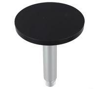
M90SD GNSS Base With 5/8-11 Thread For Vehicle Moisture-Proof Anti-Rust Mapping Surveying Adapter 91Mm
£13.89
Amazon-marketplace.co.uk
Delivery from £3.00

DJI Drone Mapping for Business: A Complete Guide to Aerial Surveying, 3D Modeling, and Industry Applications with DJI Drones
£11.48
amazon.co.uk
Free Delivery
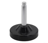
M110SLD Antenna Base Adapter Mount 5/8-11 Thread For GPS GNSS Survey | Metal Construction, Threaded Connectors, IP66 Rating, For Land Surveying And Geospatial Mapping
£21.34
Amazon-marketplace.co.uk
Delivery from £3.00

GATHINESS Balloon mapping weather balloon circular latex balloon 130g 72in inflated for recreational aerial video and payload lifts
£11.09
Amazon-marketplace.co.uk
Free Delivery

Earth Observation Applications to Landslide Mapping, Monitoring and Modeling: Cutting-edge Approaches with Artificial Intelligence, Aerial and Satellite Imagery
£108.49
Amazon-marketplace.co.uk
Free Delivery
Don't forget your voucher code:
Report Illegal Concerns
You are about to report a violation based on the EU Digital Services Act (DSA).