M90SD GNSS Base With 5/8-11 Thread For Vehicle Moisture-Proof Anti-Rust Mapping Surveying Adapter 91Mm
£13.89
Amazon-marketplace.co.uk
Delivery from £3.00
Earth Observation Applications to Landslide Mapping, Monitoring and Modeling: Cutting-edge Approaches with Artificial Intelligence, Aerial and Satellite Imagery
£108.49
Amazon-marketplace.co.uk
Free Delivery
M110SLD Antenna Base Adapter Mount 5/8-11 Thread For GPS GNSS Survey | Metal Construction, Threaded Connectors, IP66 Rating, For Land Surveying And Geospatial Mapping
£21.34
Amazon-marketplace.co.uk
Delivery from £3.00

DJI Drone Mapping for Business: A Complete Guide to Aerial Surveying, 3D Modeling, and Industry Applications with DJI Drones
£11.48
amazon.co.uk
Free Delivery
High GNSS GPS L1/L2/L5 Multi-Band for Surveying GIS Mapping - IP68 Waterproof External Aerial with Magnetic Base 150mm(A set of Orange)
£51.25
Amazon-marketplace.co.uk
Delivery from £1.00
SHINEOFI 10pcs Silicone Shock Absorber Balls for Rc Quadcopter Gimbal Mount and Flight Controller, Vibration Dampening and Protection for Aerial Photography and Mapping
£5.79
Amazon-marketplace.co.uk
Free Delivery
Alipis 10pcs Silicone Anti Vibration Balls for Drones, Shock Absorption Dampers for Gimbal Systems and Mounts, Black Rubber Drone Damper for Aerial Photography and Mapping
£5.69
Amazon-marketplace.co.uk
Free Delivery
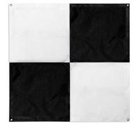
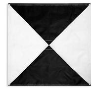
48"x48" Drone Ground Control Point GCP 6 Pack - Black/White Markers UAV Aerial Target for Mapping & Surveying
£96.72
Amazon-marketplace.co.uk
Delivery from £22.44

High GNSS GPS L1/L2/L5 Multi-Band for Surveying GIS Mapping - IP68 Waterproof External Aerial with Magnetic Base 150mm(An Antenna)
£29.33
Amazon-marketplace.co.uk
Delivery from £1.00

DECORNIJIA Blue Latex Weather Balloon 72In Extra Large for Payload Lift and Aerial Research, Suitable for School Events and Mapping Projects
£9.79
Amazon-marketplace.co.uk
Free Delivery

DJI Drone Mapping for Business: A Complete Guide to Aerial Surveying, 3D Modeling, and Industry Applications with DJI Drones
£21.12
amazon.co.uk
Free Delivery

HOLIDYOYO Large Weather Balloon Blue Latex for Aerial Survey and Scientific Weather Balloon with Extended Flight for Outdoor Mapping and Payloads, 72in Inflated, 130g
£11.09
Amazon-marketplace.co.uk
Free Delivery

High GNSS GPS L1/L2/L5 Multi-Band for Surveying GIS Mapping - IP68 Waterproof External Aerial with Magnetic Base 150mm(Antenna with Base)
£40.43
Amazon-marketplace.co.uk
Delivery from £1.00
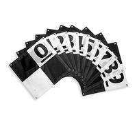
Cyiwniao 10 Pack Ground Control Points for GCP Drone,Center Eyelet Numbered 0-9, 24" x 24" Black/White Aerial Marker Target UAV for Pix4D Compatible Mapping and Surveying
£73.92
Amazon-marketplace.co.uk
Delivery from £17.77
The 2027-2032 World Outlook for Aerial Imaging Geospatial Mapping
£890.00
amazon.co.uk
Free Delivery
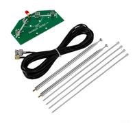
V-Type Dipole Antenna Kit With Adjustable-Frequency Optimized Signal Reception For Aviation Weather-Satellite Data Reception(Antenna cable)
£13.79
Amazon-marketplace.co.uk
Delivery from £0.99
Angoily Professional Weather Balloon for Meteorological Observation and Aerial Photography, Giant 72in Circular Latex Balloon, Lightweight 130g with Extended Flight for Mapping and Party
£10.49
Amazon-marketplace.co.uk
Free Delivery

Aerial Mapping with Drones for Land Developers: Terrain Scanning, Volume Analysis & CAD-Ready Survey Data
£14.81
amazon.co.uk
Free Delivery
BESPORTBLE Professional Extended Flight and Exceptional Visibility Large Blue Latex Weather Balloon Circular Shape 130g Weight for Aerial Survey and Science Experiments for Outdoor Mapping
£8.84
Amazon-marketplace.co.uk
Free Delivery

BESPORTBLE Latex Giant Weather Balloon Blue 72in for Balloon Mapping and Aerial Meteorological Data Acquisition with Stable Payload Lift, Suitable for Recreation and Parties
£9.29
Amazon-marketplace.co.uk
Free Delivery

MAGICLULU Professional Weather Balloon for Aerial Photography and Mapping Large 72in Blue Latex Balloon Exceptional Visibility and Extended Flight for Scientific and Outdoor Use
£9.14
Amazon-marketplace.co.uk
Free Delivery

PRETYZOOM Extra Large Giant Weather Balloon Blue Latex 130g for Aerial Meteorological Observation and Mapping Projects, Circular Shape, Suitable for Payloads and Outdoor Experiments
£8.86
Amazon-marketplace.co.uk
Free Delivery

High GNSS GPS L1/L2/L5 Multi-Band for Surveying GIS Mapping - IP68 Waterproof External Aerial with Magnetic Base 150mm(A set of Black)
£51.24
Amazon-marketplace.co.uk
Delivery from £1.00

OUNONA Red Latex Meteorological Observation Balloon for Weather Mapping and Aerial Video, 200g Lightweight Huge Party Balloon Easy Tracking and High Space Performance, for Meteorological
£26.49
Amazon-marketplace.co.uk
Free Delivery
Hemobllo Professional Large Circular Weather Balloon for Meteorological Research and Mapping, Black Latex Material with Extended Height Reach and Aerial Data Acquisition, for Observation
£10.09
Amazon-marketplace.co.uk
Free Delivery
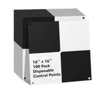
Disposable Drone Ground Control Point GCP 100 Pack - 16"x16" Black/WhiteMarkers UAV Aerial Target for Mapping & Surveying
£110.05
Amazon-marketplace.co.uk
Delivery from £36.28
Healeved Giant Black Meteorological Balloon for Aerial Survey and Mapping, Latex Material with Extended Flight and Steady Lift for Payloads, Circular Shape, 130g Lightweight Party
£9.59
Amazon-marketplace.co.uk
Free Delivery
HanOaki STA-55H GNSS Antenna Shell, Weather-Resistant ASA Construction with IP67 Waterproof Dustproof Cover, for Precise Surveying Positioning
£16.07
Amazon-marketplace.co.uk
Delivery from £1.99

VERDANVERSE 10pcs Silicone Shock Absorption Balls for Rc Quadcopter Flight Controller, Heavy Duty Silicone Material with Anti-vibration Protection, for Aerial Photography and Mapping
£5.49
Amazon-marketplace.co.uk
Free Delivery

V-Type Dipole Antenna Kit With Adjustable-Frequency Optimized Signal Reception For Aviation Weather-Satellite Data Reception(Telescopic Antenna)
£7.89
Amazon-marketplace.co.uk
Delivery from £0.99

Ag Drone Operator Precision Farming Aerial Crop Scouting Case for iPhone 13
£17.99
amazon.co.uk
Delivery from £4.49
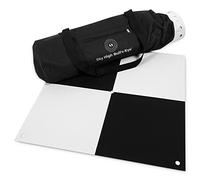
Sky High Bull's-Eye 6 Pack Rubber Weighted Aerial Mapping & Surveying GCPs/Targets (24x24", High-Contrast, Center Hole)
£248.20
Amazon-marketplace.co.uk
Delivery from £68.81

GATHINESS Balloon mapping weather balloon circular latex balloon 130g 72in inflated for recreational aerial video and payload lifts
£10.59
Amazon-marketplace.co.uk
Free Delivery

Ag Drone Operator Precision Farming Aerial Crop Scouting PopSockets PopGrip for MagSafe
£28.99
amazon.co.uk
Free Delivery

54 * 16 mm EA5416 Brushless Motor Aerial Photography Mapping Rotor Vertical Take-off And Landing Motor Fit For Drone
£333.45
Amazon-marketplace.co.uk
Free Delivery
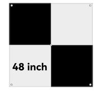
Sky High Bull's-Eye (48"x48") UAV Drone Ground Control Points (GCPs)/Aerial Targets for Mapping & Surveying (6 Pack) | Center Passthrough (Black/White Markers) | Pix4D & DroneDeploy Compatible
£145.22
Amazon-marketplace.co.uk
Delivery from £22.72
XL UAV Ground Control Points (GCPs)/Aerial Targets for Aerial Mapping & Surveying (6 Pack) with Center Passthrough (1 m x 1 m)
£147.96
Amazon-marketplace.co.uk
Delivery from £20.41
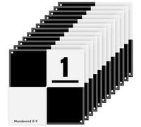
UAV Ground Control Points (GCPs)/Aerial Targets for Aerial Mapping & Surveying (10 Pack) with Center Passthrough Numbered 0-9 (Black & White)
£101.34
Amazon-marketplace.co.uk
Delivery from £18.34
- 1
- 2
- 3
- 4
- 5
- next page
🤖 Ask ChatGPT
🛍️ What are the most important purchase criteria?
💰 Tell me the best deals!
📋 Create a short summary!
Informations about "aerial mapping for"
Having searched the market for the cheapest prices of sale, 182 bids were found for comparison.
Furthermore, a large number of offers in 42 relevant categories with a price range from £4.82 to £890.00 were found.
About "aerial mapping for"
- Overall, our search showed 4 different online stores for your product "aerial mapping for", including Amazon-marketplace.co.uk, amazon.co.uk, Whsmith.co.uk and debenhams.com.
- If you would prefer an item from a particular manufacturers, you can find 6 online stores for this product. If you have not yet made a decision, you can also filter your favourite manufacturers and choose between 6 manufacturers.
- The most bids (32) were found in the price range from £17.00 to £17.99.
- Furthermore, other users were also interested in the following product: .
- Personalise your product by choosing one of the 9 coloration.
How well did the information meet your expectations and assist you further?
Your responses remain anonymous and are used solely to improve our website. No personal data will be stored or shared with third parties.
Don't forget your voucher code:
Report Illegal Concerns
You are about to report a violation based on the EU Digital Services Act (DSA).