
Postcode Sector Map - (S14) - Northern Ireland - Wall Map-Paper
Promotion

Overall Rating: 2.4 / 5 (average from multiple review sources, as of 10 Mar 2026)
Based on a total of 46,572 customer reviews from independent review platforms.
Sources & Transparency:
The values are derived from publicly available retailer ratings from platforms such as Feefo, http://Reviews.io , Trustpilot, and others, and are aggregated monthly.
All brand names and logos are the property of their respective owners.
Notice:
pricehunter.co.uk cannot guarantee that published shop ratings originate from consumers who have actually made a purchase from the reviewed retailer.
Postcode Sector Map - (S14) - Northern Ireland - Wall Map-Paper
£29.99
Free Delivery
Postcode Sector Map - (S14) - Northern Ireland - Wall Map-Paper

Cheapest Total Price
In stock
Direct debit
Direct debit
Visa
Visa
Mastercard
Mastercard
£29.99
Free Delivery
Postcode Sector Map - (S14) - Northern Ireland - Wall Map-Paper
Overall Rating: 2.4 / 5 (average from multiple review sources, as of 10 Mar 2026)
Based on a total of 46,572 customer reviews from independent review platforms.
Sources & Transparency:
The values are derived from publicly available retailer ratings from platforms such as Feefo, http://Reviews.io , Trustpilot, and others, and are aggregated monthly.
All brand names and logos are the property of their respective owners.
Notice:
pricehunter.co.uk cannot guarantee that published shop ratings originate from consumers who have actually made a purchase from the reviewed retailer.
Based on a total of 46,572 customer reviews from independent review platforms.
Sources & Transparency:
The values are derived from publicly available retailer ratings from platforms such as Feefo, http://Reviews.io , Trustpilot, and others, and are aggregated monthly.
All brand names and logos are the property of their respective owners.
Notice:
pricehunter.co.uk cannot guarantee that published shop ratings originate from consumers who have actually made a purchase from the reviewed retailer.
Cheapest Total Price
In stock. Express Delivery available with Amazon Prime.
Direct debit
Direct debit
Visa
Visa
Mastercard
Mastercard
£29.99
Free Delivery
🤖 Ask ChatGPT
💡 Is it worth the price?
🔁 Better alternatives?
⭐ What do users say?
Postcode Sector Map - (S14) - Northern Ireland - Wall Map-Paper - Details
▶ Finding you the best price!
We have found 2 prices for Postcode Sector Map - (S14) - Northern Ireland - Wall Map-Paper. Our price list is completely transparent with the cheapest listed first. Additional delivery costs may apply.
Postcode Sector Map - (S14) - Northern Ireland - Wall Map-Paper - Price Information
- Cheapest price: £29.99
- The cheapest price is offered by Amazon-marketplace.co.uk. You can order the product there.
- The price range for the product Postcode Sector Map - (S14) - Northern Ireland - Wall Map-Paper is €£29.99to €£29.99 with a total of 2 offers.
- Payment methods: The online shop Amazon-marketplace.co.uk supports: Direct debit, Visa, Mastercard
- Delivery: The shortest delivery time is In stock working days offered by Amazon-marketplace.co.uk.
Similar products
Northern Ireland Postcode Sector Wall Map (S14) - 47" x 33.25" Laminated
£77.99
Amazon-marketplace.co.uk
Delivery from £7.69

Glasgow and the Clyde - Postcode Sector Map 25 - Wall Map With Motorway, A' Roads, B' Roads, City Plans, Area, District, Size: 73 x 107 cm (29 x 42 inches) Scale: 1:150 000 (2.4 miles to 1 inch)
£18.99
Amazon-marketplace.co.uk
Free Delivery

Yorkshire & East Riding LEEDS/BRADFORD - Postcode Sector Map 20 - Wall Map With Motorway, A' Roads, B' Roads, City Plans, Area, District, Sectors Size: 73 x 107 cm Scale: 1:150,000- Laminated
£25.99
Amazon-marketplace.co.uk
Free Delivery

North Devon Postcode Sector Wall Map- Postcode Sector Map 2 - Laminated Wall Map With Motorway, A' Roads, B' Roads, City Plans, Area, District, Sectors
£34.95
Amazon-marketplace.co.uk
Free Delivery

East Anglia - Postcode Sector Map 15 - Wall Map With Motorway, A' Roads, B' Roads, City Plans, Area, District, SectorsSize: 73 x 107 cm (29 x 42 inches) Scale: 1:150 000 (2.4 miles to 1 inch)
£24.99
Amazon-marketplace.co.uk
Free Delivery
Cheapest offer
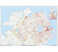
This Northern Ireland Sector Wall Map shows detailed Postcode Sector Boundaries (BT1 1, BT1 2) on a Comprehensive Background A0 Size - 1189mm x 841mm Art quality 120 gsm paper
£29.99
In stock
Amazon-marketplace.co.uk
Don't forget your voucher code:
Report Illegal Concerns
You are about to report a violation based on the EU Digital Services Act (DSA).