
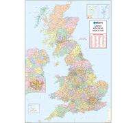
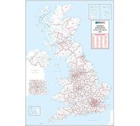
UK Political - Postcode District Wall Map (6'x4')-Paper
UK Political - Postcode District Wall Map (6'x4')-Paper

Cheapest Total Price
In stock
Direct debit
Direct debit
Visa
Visa
Mastercard
Mastercard
£69.99
Free Delivery
UK Political - Postcode District Wall Map (6'x4')-Paper

Overall Rating: 2.4 / 5 (average from multiple review sources, as of 23 Feb 2026)
Based on a total of 46,432 customer reviews from independent review platforms.
Sources & Transparency:
The values are derived from publicly available retailer ratings from platforms such as Feefo, http://Reviews.io , Trustpilot, and others, and are aggregated monthly.
All brand names and logos are the property of their respective owners.
Notice:
pricehunter.co.uk cannot guarantee that published shop ratings originate from consumers who have actually made a purchase from the reviewed retailer.
Cheapest Total Price
In stock. Express Delivery available with Amazon Prime.
Direct debit
Direct debit
Visa
Visa
Mastercard
Mastercard
£69.99
Free Delivery
🤖 Ask ChatGPT
💡 Is it worth the price?
🔁 Better alternatives?
⭐ What do users say?
UK Political - Postcode District Wall Map (6'x4')-Paper - Details
▶ Finding you the best price!
We have found 2 prices for UK Political - Postcode District Wall Map (6'x4')-Paper. Our price list is completely transparent with the cheapest listed first. Additional delivery costs may apply.
UK Political - Postcode District Wall Map (6'x4')-Paper - Price Information
- Cheapest price: £69.99
- The cheapest price is offered by Amazon-marketplace.co.uk. You can order the product there.
- The price range for the product UK Political - Postcode District Wall Map (6'x4')-Paper is €£69.99to €£69.99 with a total of 2 offers.
- Payment methods: The online shop Amazon-marketplace.co.uk supports: Direct debit, Visa, Mastercard
- Delivery: The shortest delivery time is In stock working days offered by Amazon-marketplace.co.uk.
Similar products

£69.99
Amazon-marketplace.co.uk
Free Delivery
XYZ Maps UK Postcode Areas Wall Map - 100 cm x 141 cm - England, Scotland & Wales - Political Postcode Boundaries - Plastic Coated, Waterproof & Wipeable for Office & Classroom
£79.99
Amazon-marketplace.co.uk
Free Delivery

UK Political Postcode District Wall Map (D8) - 47" x 66.25" Paper
£87.99
Amazon-marketplace.co.uk
Delivery from £27.69
UK White Postcode Areas Wall Map -100 cm x 141 cm - England, Scotland & Wales - Plain Background - Plastic Coated, Waterproof & Wipeable - Ideal for Office & Classroom
£79.99
Amazon-marketplace.co.uk
Free Delivery
Cheapest offer
High Quality Map of UK Postcodes. Shows District Boundaries and District Labels on a Map Background. 2A in Size, (119cm x 168cm) Double size 2A - 1682 mm x 1189 mm Art quality 120 gsm paper
£69.99
In stock
Amazon-marketplace.co.uk
Don't forget your voucher code:
Report Illegal Concerns
You are about to report a violation based on the EU Digital Services Act (DSA).