
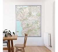
Atlas & Green World Map Travel Gift, A3 Scratchable Poster + Bonus A4 UK Map, Maps of Visited Countries with Accessories, Kit Tube, Cartographic Design
£16.95
Amazon-marketplace.co.uk
Delivery from £4.49

£11.23
Amazon-marketplace.co.uk
Delivery from £2.80
£69.99
Amazon-marketplace.co.uk
Free Delivery

£11.85
amazon.co.uk
Free Delivery

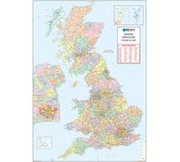
UK Map - Classic Wall Map Of The United Kingdom Poster - Front Lamination - A1, 84 x 59cm
£16.49
Amazon-marketplace.co.uk
Delivery from £4.49
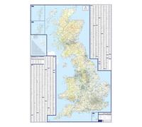
UK Roads Wall Map - Laminated Large Wall Map - 120cm X 83cm - Clearly Shows Motorways, A, B & Minor Roads, Postcode Areas, London Inset With M25
£29.99
Amazon-marketplace.co.uk
Free Delivery
£9.20
amazon.co.uk
Delivery from £2.99
£9.20
amazon.co.uk
Delivery from £2.99
£17.10
Whsmith.co.uk
Delivery from £3.99
£8.91
Amazon-marketplace.co.uk
Delivery from £2.80

UK National Park Wall Map - The Peak District - Large 106 x 132cm Wall Map - Ordnance Survey's Landranger Base, Great For Walkers, Adventures, Explorers And Outdoor Enthusiasts
£34.99
Amazon-marketplace.co.uk
Free Delivery
UK National Park Wall Map - The Yorkshire Dales - Large 120cm X 150cm Wall Map - Ordnance Survey Landranger Base, Great For Walkers, Adventures, Explorers And Outdoor Enthusiasts
£34.99
Amazon-marketplace.co.uk
Free Delivery

UK National Park Wall Map - Dartmoor - Large 87 x 109cm Wall Map - Ordnance Survey's Landranger Base, Great For Walkers, Adventures, Explorers And Outdoor Enthusiasts
£34.99
Amazon-marketplace.co.uk
Free Delivery
£69.99
Amazon-marketplace.co.uk
Free Delivery
UK National Park Wall Map - Snowdonia - Large 120cm X 172cm Wall Map - Ordnance Survey Landranger Base, Great For Walkers, Adventures, Explorers And Outdoor Enthusiasts
£34.99
Amazon-marketplace.co.uk
Free Delivery

Supersize UK Great Britain Map with Counties Lines, Postcodes And Population Details Aluminium framed Wall Map of UK Size: 120 x 174 cm (47 x 68 inches). Scale 1:440 000
£165.99
Amazon-marketplace.co.uk
Free Delivery
UK Postcode Wall Map - Large Wall Map - 120cm X 83cm - Clearly Shows Postcode, County And District Boundaries, Main Roads, Cities, Towns And Villages (Paper)
£18.99
Amazon-marketplace.co.uk
Free Delivery

UK Wall Map -Laminated With Dark Wood Frame Large Map - British Isles County, District and Unitary Authority Boundaries | Local District Councils, Roadmap, Postcode Areas, London Boroughs
£88.99
Amazon-marketplace.co.uk
Free Delivery

UK Roads Wall Map - Large Laminated And Aluminum Framed Wall Map - 120cm X 83cm - Clearly Shows Motorways, A Roads, B Roads, Minor Roads, Postcode Areas, London Inset With M25
£89.99
Amazon-marketplace.co.uk
Free Delivery

UK Wall Map -Large Laminated With Light Wood Frame Map - British Isles County, District and Unitary Authority Boundaries | Local District Councils, Roadmap, Postcode Areas, London Boroughs,
£89.99
Amazon-marketplace.co.uk
Free Delivery

UK Wall Map - Large Laminated And Aluminum Framed Map - British Isles Counties, District and Unitary Authority Boundaries | Local District Councils, Roadmap, Postcode Areas, London Boroughs,
£89.99
Amazon-marketplace.co.uk
Free Delivery
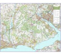
UK National Park Wall Map - New Forest - Large 74cm X 92cm Wall Map - Ordnance Survey Landranger Base, Great For Walkers, Adventures, Explorers And Outdoor Enthusiasts
£34.99
Amazon-marketplace.co.uk
Free Delivery
UK Wall Map -Large Laminated Black Wood Framed Map - British Isles County, District and Unitary Authority Boundaries | Local District Councils, Roadmap, Postcode Areas, London Boroughs, Pop Figures
£89.99
Amazon-marketplace.co.uk
Free Delivery
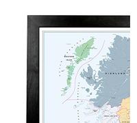
XYZ Maps Scotland Postcode Areas Wall Map - Physical Map Showing UK National Postcode Regions - 700 x 880 mm - 120gsm Art Quality Paper - Ideal for Office, Planning & Education
£27.99
Amazon-marketplace.co.uk
Free Delivery
Britain Illustrated Peak District Map Poster Print Vintage Style. 8 x 10, 11 x 14, 16 x 20, 18 x 24 Inches. Blue. UK National Park Art. Gift For Walkers, Hikers, Cyclists And Outdoor Enthusiasts.
£15.00
Amazon-marketplace.co.uk
Delivery from £4.59
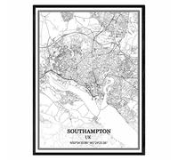
TANOKCRS Southampton UK Map Wall Art Canvas Print Poster Artwork Unframed Modern Black and White Map Souvenir Gift Home Decor 9x11 inches
£9.77
Amazon-marketplace.co.uk
Delivery from £4.00

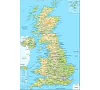
Laminated Posters HUGE LAMINATED/ENCAPSULATED Map Of The UK British Isles GB Road Map POSTER Measures 36 x 24 inches (91.5 x 61 cm)
£15.99
Amazon-marketplace.co.uk
Delivery from £6.00

Scratchable UK Map, A2 Poster + Accessories Kit & Travel Tube, Campervan Day Trips, Journal Wall Art, Nebula Watercolour Designed
£14.95
Amazon-marketplace.co.uk
Delivery from £4.49

TANOKCRS London UK Map Wall Art Canvas Print Poster Artwork Unframed Modern Black and White Map Souvenir Gift Home Decor -11 * 14 inches
£13.33
Amazon-marketplace.co.uk
Delivery from £4.00
Map of Great Britain UK England Scotland Wales & Northern Ireland Poster A1 A2 A3 - Wall Art Print (A2)
£9.00
Amazon-marketplace.co.uk
Delivery from £4.00
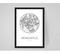
Personalised Newcastle UK Custom City/Town Map, Any Location/Home Decor (A4 Print (210x297mm) 8.27x11.69 in)
£10.77
Amazon-marketplace.co.uk
Delivery from £1.99

Maps International Scratch Off Marathon Map - UK & Ireland Poster - gifts for runners - 42 x 30cm 50 Years of Map Making
£11.99
Amazon-marketplace.co.uk
Delivery from £4.49

Road Map of the UK - Size A1-59.4 x 84.1cm - Paper Laminated
£17.10
Amazon-marketplace.co.uk
Delivery from £4.00
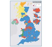
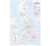
Large UK Parliamentary Constituency Boundary Wall Map (December 2019 results) (Laminated)
£37.50
Amazon-marketplace.co.uk
Delivery from £2.80

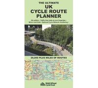
The Ultimate UK Cycle Route Planner Map: 20,000 Plus Miles of Leisure Routes by Richard Peace (2016-03-15)
£10.95
Amazon-marketplace.co.uk
Delivery from £2.80
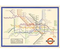
London Underground Poster | Harry Beck's Tube map | Vintage London Print | 1933 | Antique British Map | Retro Subway Map | UK Wall Art (200gsm Satin Paper, A1: 33.1 x 23.4 in)
£29.99
Amazon-marketplace.co.uk
Delivery from £3.00
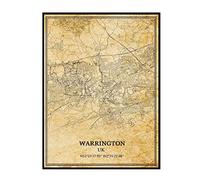
TANOKCRS Warrington UK Vintage Map Poster Artwork Wall Art City Road Map Print Travel Souvenir Gift Home Decor Unframed
£14.12
Amazon-marketplace.co.uk
Delivery from £4.00
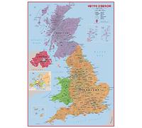
Large Primary UK Wall Map Political (Laminated)
£37.50
Amazon-marketplace.co.uk
Delivery from £2.80

Britain Illustrated Peak District Map Poster Print Vintage Style. 8 x 10, 11 x 14, 16 x 20, 18 x 24 Inches. Blue. UK National Park Art. Gift For Walkers, Hikers, Cyclists And Outdoor Enthusiasts.
£20.00
Amazon-marketplace.co.uk
Delivery from £2.80
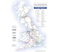
UK Rail Network Wall Map 2025 - Laminated 60th Edition by Barry Doe - Updated UK Train Operator Routes with Metro & Tram Links - 72 x 100cm Dry Wipe Railway Map
£22.99
Amazon-marketplace.co.uk
Free Delivery
- 1
- 2
- 3
- 4
- 5
- next page
🤖 Ask ChatGPT
🛍️ What are the most important purchase criteria?
💰 Tell me the best deals!
📋 Create a short summary!
Informations about "uk in maps"
Having searched the market for the cheapest prices of sale, 7,803 bids were found for comparison.
Furthermore, a large number of products in 45 relevant categories with a price range from £0.89 to £902.53 were found.
About "uk in maps"
- Overall, our search showed 15 different online shops for your product "uk in maps", including Amazon-marketplace.co.uk, Millets.co.uk, loaded.com(UK) and expresstrainers.com.
- After having chosen your supplier you may also choose the delivery company. 14 delivery brands are available Generic Sports, The AA, Garmin and Collins being the most popular.
- The most bids (1,229) were found in the price range from £7.00 to £7.99.
- Furthermore, other users were also interested in the following product: .
- Personalise your product by choosing one of the 259 shades.
Don't forget your voucher code:
Report Illegal Concerns
You are about to report a violation based on the EU Digital Services Act (DSA).